Latitude: 52.1299 / 52°7'47"N
Longitude: -3.1014 / 3°6'5"W
OS Eastings: 324701
OS Northings: 248529
OS Grid: SO247485
Mapcode National: GBR F2.7TKV
Mapcode Global: VH77M.6Q8K
Plus Code: 9C4R4VHX+XC
Entry Name: Upper Bridge
Listing Date: 31 October 1988
Grade: II
Source: Historic England
Source ID: 1180081
English Heritage Legacy ID: 150575
ID on this website: 101180081
Location: County of Herefordshire, HR3
County: County of Herefordshire
Civil Parish: Brilley
Traditional County: Herefordshire
Lieutenancy Area (Ceremonial County): Herefordshire
Church of England Parish: Brilley with Michaelchurch
Church of England Diocese: Hereford
Tagged with: Bridge
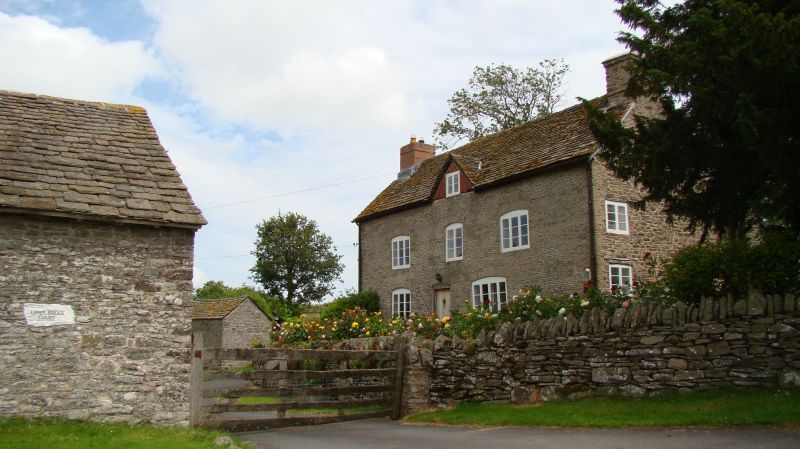
BRILLEY CP - SO 24 NW 4/22 Upper Bridge GV II Shown on OS Map as Upper Bridge Court. Farmhouse, now house. C18, altered mid-C19. Coursed dressed rubble, stone tiled roof laid in diminishing courses with brick end stacks. Two storeys, attic with dormers, and cellar. Three bays. Main window openings have cambered heads. There is a 3-light and a 4-light casement on the ground floor and two 3-light casements and a central 2-light casement on the first floor. Above is a central gabled brick dormer with a 2-light casement. The central entrance has a cambered head and a C20 door. There is a cellar door to the left of the front elevation. Lean-to outshut to rear right.
Listing NGR: SO2470148529
External links are from the relevant listing authority and, where applicable, Wikidata. Wikidata IDs may be related buildings as well as this specific building. If you want to add or update a link, you will need to do so by editing the Wikidata entry.


Other nearby listed buildings