Latitude: 51.1635 / 51°9'48"N
Longitude: -1.4489 / 1°26'55"W
OS Eastings: 438634
OS Northings: 140618
OS Grid: SU386406
Mapcode National: GBR 736.SNK
Mapcode Global: VHC35.T0XW
Plus Code: 9C3W5H72+CF
Entry Name: Aldings
Listing Date: 20 December 1960
Grade: II
Source: Historic England
Source ID: 1179602
English Heritage Legacy ID: 139728
ID on this website: 101179602
Location: Wherwell, Test Valley, Hampshire, SP11
County: Hampshire
District: Test Valley
Civil Parish: Wherwell
Built-Up Area: Wherwell
Traditional County: Hampshire
Lieutenancy Area (Ceremonial County): Hampshire
Church of England Parish: Wherwell St Peter and Holy Cross
Church of England Diocese: Winchester
Tagged with: Building Thatched cottage
SU 34 SE WHERWELL FULLERTON ROAD 20-12-60 3/34 Aldings
II
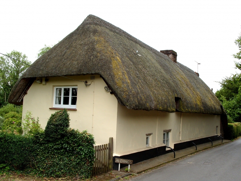
Formerly a pair of cottages, now one dwelling. Mid C18. Rendered walls and thatched roof. The main elevation (east) faces the river, and has 1 storey and attic, 5 upper windows. The hipped roof is brought low at the south end above an outshot (which is clad in vertical rustic poles), the eaves are raised above the dormers (with cills at eaves level): on the road elevation there are 2 eyebrow dormers. The plain walls have a high plinth to the road elevation; on the east elevation the triangular sides to the dormers are of painted brick within timber framework, set back from the thick walls (probably of cob). Casements. One boarded door beneath a canopy on poles and a French door within a wide glazed verandah. Lead Sun fire-insurance sign.
Listing NGR: SU3863640618
External links are from the relevant listing authority and, where applicable, Wikidata. Wikidata IDs may be related buildings as well as this specific building. If you want to add or update a link, you will need to do so by editing the Wikidata entry.


Other nearby listed buildings