Latitude: 50.8994 / 50°53'57"N
Longitude: -1.4055 / 1°24'19"W
OS Eastings: 441905
OS Northings: 111274
OS Grid: SU419112
Mapcode National: GBR RQH.94
Mapcode Global: FRA 76YQ.N8V
Plus Code: 9C2WVHXV+QR
Entry Name: 5, St Michael's Square
Listing Date: 11 November 1974
Grade: II
Source: Historic England
Source ID: 1179171
English Heritage Legacy ID: 135922
ID on this website: 101179171
Location: Southampton, Hampshire, SO14
County: City of Southampton
Electoral Ward/Division: Bargate
Parish: Non Civil Parish
Built-Up Area: Southampton
Traditional County: Hampshire
Lieutenancy Area (Ceremonial County): Hampshire
Church of England Parish: Southampton City Centre St Mary
Church of England Diocese: Winchester
Tagged with: Building
1. ST MICHAEL'S SQUARE 5239 No 5 SU 4111 3/230 11.11.74
II GV
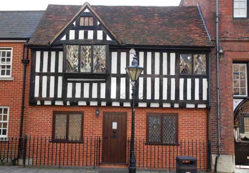
2. C16 or earlier timber-framed building. Tiled roof. Two storeys. First floor has exposed square framing. Ground floor brick. Gable. Two modern casements to first floor. Modern shop-front to ground floor.
Listing NGR: SU4190511270
External links are from the relevant listing authority and, where applicable, Wikidata. Wikidata IDs may be related buildings as well as this specific building. If you want to add or update a link, you will need to do so by editing the Wikidata entry.


Other nearby listed buildings