Latitude: 54.4453 / 54°26'42"N
Longitude: -0.9799 / 0°58'47"W
OS Eastings: 466251
OS Northings: 506020
OS Grid: NZ662060
Mapcode National: GBR PKL1.N8
Mapcode Global: WHF8T.XJKJ
Plus Code: 9C6XC2WC+43
Entry Name: Westerdale Hall
Listing Date: 20 December 1990
Grade: II
Source: Historic England
Source ID: 1179138
English Heritage Legacy ID: 328064
ID on this website: 101179138
Location: Westerdale, North Yorkshire, YO21
County: North Yorkshire
District: Scarborough
Civil Parish: Westerdale
Traditional County: Yorkshire
Lieutenancy Area (Ceremonial County): North Yorkshire
Church of England Parish: Westerdale Christ Church
Church of England Diocese: York
Tagged with: House
NZ 60 NE WESTERDALE MAIN STREET Westerdale West side (off)
6/146 Westerdale Hall
II
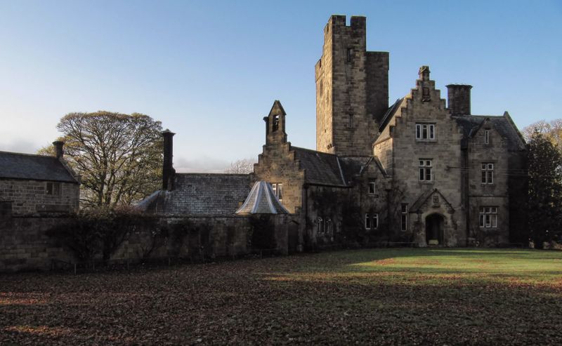
House, now Youth Hostel. Shooting-box for the Duncombe family, before 1874. Coursed squared sandstone with ashlar dressings; Lakeland slate and lead roofs. Baronial Tudor style. Square plan with canted south-eastern extensions enclosing service courtyard.
Very irregular elevations ranging in height from 1 to 5 storeys, with even higher tower stair turret. Crow-stepped gables. Stone- mullioned windows of varying sizes, some with transoms; window woodwork mostly replaced.
Entrance front 2 storeys and attics of varying heights, 3 irregular bays. Central open porch with Tudor arch and blank shield over. Tudor-arched inner door. At left the canted screen wall has another such door and to left of it an octagonal pavilion with tented lead roof. Right return has battered lower courses and some original leaded glazing in window heads. 3-bay garden front has gabled left bay with 2-storey square window projection, central stair window with armorial glass, and massive 5-storey battlemented tower at right.
Row of conjoined diagonal stacks above the left ridge and another row on the 2-storey service wing on south side of courtyard.
Pevsner, N. Riding p.384.
Listing NGR: NZ6625106020
External links are from the relevant listing authority and, where applicable, Wikidata. Wikidata IDs may be related buildings as well as this specific building. If you want to add or update a link, you will need to do so by editing the Wikidata entry.


Other nearby listed buildings