Latitude: 52.588 / 52°35'16"N
Longitude: -0.7213 / 0°43'16"W
OS Eastings: 486725
OS Northings: 299678
OS Grid: SP867996
Mapcode National: GBR CSK.QG0
Mapcode Global: WHFL1.W6PT
Plus Code: 9C4XH7QH+5F
Entry Name: Baxters
Listing Date: 10 November 1955
Last Amended: 15 October 1984
Grade: II
Source: Historic England
Source ID: 1178159
English Heritage Legacy ID: 186776
ID on this website: 101178159
Location: Uppingham, Rutland, LE15
County: Rutland
Civil Parish: Uppingham
Built-Up Area: Uppingham
Traditional County: Rutland
Lieutenancy Area (Ceremonial County): Rutland
Church of England Parish: Uppingham St Peter and St Paul
Church of England Diocese: Peterborough
Tagged with: Building
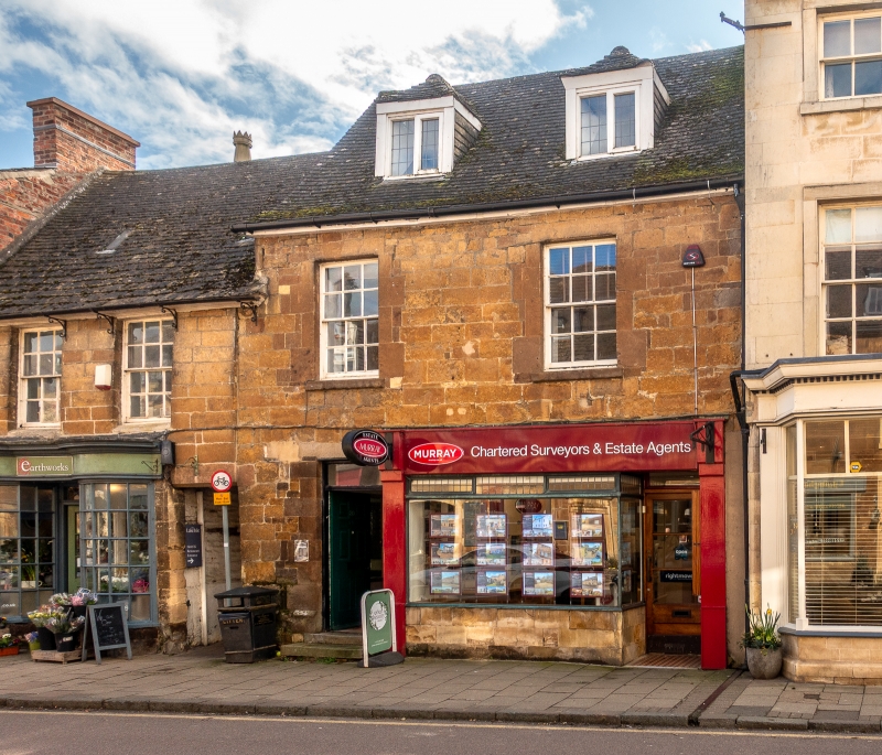
SP 8699-8799 UPPINGHAM HIGH STREET EAST 4/38 (south side) 10.11.55 Nos 18 and 20 (Baxters) (previously listed as Premises 40 yards west of Queen Street) GV II
House, incorporating shop. C17/18. Squared stone with plain tile roof and brick west end stack on stone base. Two storeys and attic. Two window range. Ground floor has panelled door to left with rectangular overlight and C20 shop to right. First floor has 6/6 sash windows with chamfered heads. Two hipped 2-light casement dormers, one with leaded panes. Wing to rear with coped gable.
Listing NGR: SP8672799672
External links are from the relevant listing authority and, where applicable, Wikidata. Wikidata IDs may be related buildings as well as this specific building. If you want to add or update a link, you will need to do so by editing the Wikidata entry.


Other nearby listed buildings