Latitude: 51.0412 / 51°2'28"N
Longitude: -3.308 / 3°18'28"W
OS Eastings: 308397
OS Northings: 127687
OS Grid: ST083276
Mapcode National: GBR LR.GPSR
Mapcode Global: FRA 36YC.K2P
Plus Code: 9C3R2MRR+FR
Entry Name: Masonic Hall
Listing Date: 26 March 1984
Grade: II
Source: Historic England
Source ID: 1177135
English Heritage Legacy ID: 270132
ID on this website: 101177135
Location: Wiveliscombe, Somerset, TA4
County: Somerset
District: Somerset West and Taunton
Civil Parish: Wiveliscombe
Built-Up Area: Wiveliscombe
Traditional County: Somerset
Lieutenancy Area (Ceremonial County): Somerset
Tagged with: Masonic temple
ST0827 WIVELISCOMBE CP CHURCH STREET (South side)
8/56 Masonic Hall
-
- II
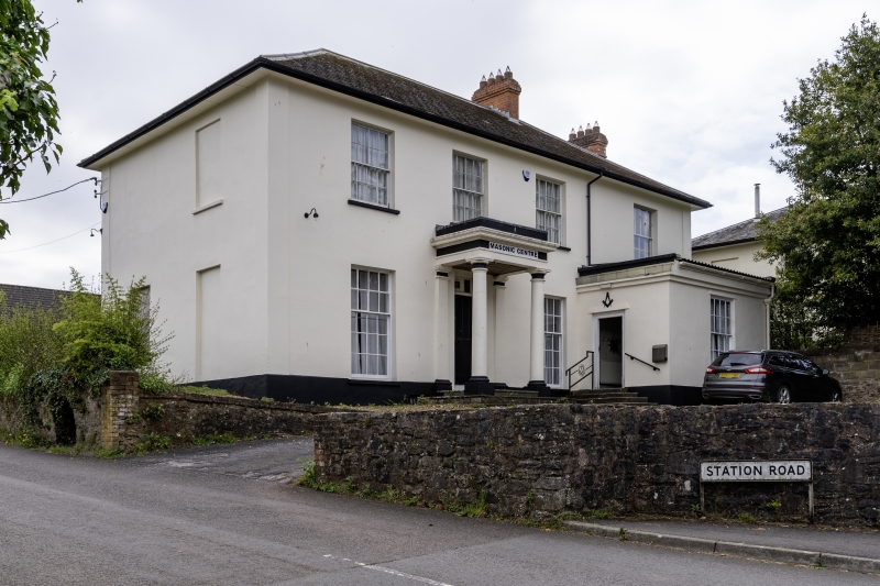
Masonic Hall. Early C19. Stucco with hipped Welsh slate roof, deep eaves and soffit board, brick stacks to right. 2-storeys, 4-bays with central porch and single storey, single bay projection with moulded cornice in front of right-hand bay. All windows sashes with glaring bars. Tuscan porch with eight panel door and wreath knocker.
Listing NGR: ST0839727687
External links are from the relevant listing authority and, where applicable, Wikidata. Wikidata IDs may be related buildings as well as this specific building. If you want to add or update a link, you will need to do so by editing the Wikidata entry.


Other nearby listed buildings