Latitude: 54.3057 / 54°18'20"N
Longitude: -1.626 / 1°37'33"W
OS Eastings: 424430
OS Northings: 490076
OS Grid: SE244900
Mapcode National: GBR KL2N.R9
Mapcode Global: WHC70.Z1VH
Plus Code: 9C6W894F+7H
Entry Name: Crakehall House
Listing Date: 22 August 1966
Grade: II
Source: Historic England
Source ID: 1174336
English Heritage Legacy ID: 332315
ID on this website: 101174336
Location: Great Crakehall, North Yorkshire, DL8
County: North Yorkshire
District: Hambleton
Civil Parish: Crakehall
Built-Up Area: Great Crakehall
Traditional County: Yorkshire
Lieutenancy Area (Ceremonial County): North Yorkshire
Tagged with: House
CRAKEHALL THE GREEN SE 2490-2590 (north side) 7/32 Crakehall House 22.8.66 GV II
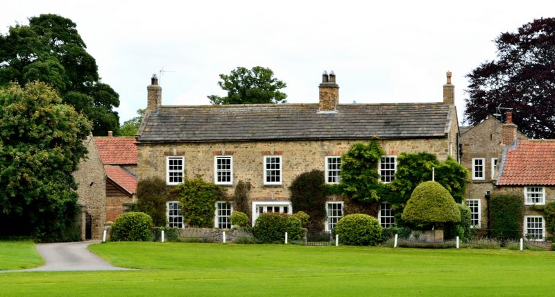
House. Mid C18. Rubblestone, brick and stone dressings, graduated stone slate roof. 2 storeys, 5 bays, symmetrical elevation. Central carriage opening with brick cambered arch, infilled by C20 4-light French window. All windows have sashes with glazing bars, with stone sills and flat brick arches with keystones. Shaped kneelers, stone coping, end stacks and one to ridge.
Listing NGR: SE2443090076
External links are from the relevant listing authority and, where applicable, Wikidata. Wikidata IDs may be related buildings as well as this specific building. If you want to add or update a link, you will need to do so by editing the Wikidata entry.


Other nearby listed buildings