Latitude: 51.1908 / 51°11'26"N
Longitude: -2.5464 / 2°32'47"W
OS Eastings: 361910
OS Northings: 143650
OS Grid: ST619436
Mapcode National: GBR MS.5BP4
Mapcode Global: VH8B0.TB5G
Plus Code: 9C3V5FR3+8C
Entry Name: Shambles
Listing Date: 20 May 1952
Grade: II
Source: Historic England
Source ID: 1173341
English Heritage Legacy ID: 266594
ID on this website: 101173341
Location: Shepton Mallet, Somerset, BA4
County: Somerset
District: Mendip
Civil Parish: Shepton Mallet
Built-Up Area: Shepton Mallet
Traditional County: Somerset
Lieutenancy Area (Ceremonial County): Somerset
Tagged with: Building
This list entry was subject to a Minor Amendment on 22 October 2025 to amend details in the description and to reformat text to current standards
ST6143
6/195
SHEPTON MALLET CP
MARKET PLACE
Shambles
20.5.52
GV
II
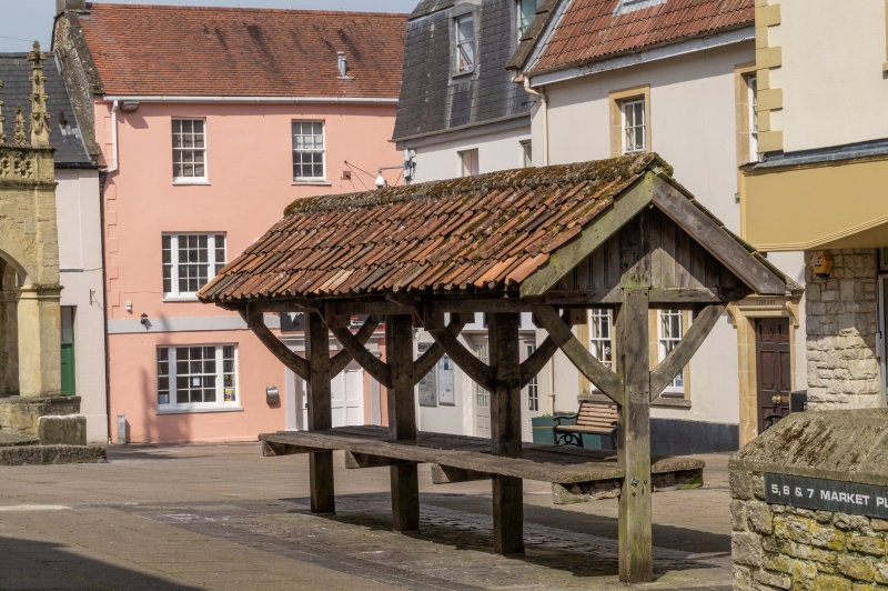
Shambles. C15, much reconstructed and restored C20. Oak with pantile roof. Consists of four-square section uprights, each of which has a pair of curved braces supporting a timber saddle canopy roof. Counter formed of planks 1 metre from ground. Short surviving portion of stalls which once ran the whole length of the Market Place.
Listing NGR: ST6191043650
External links are from the relevant listing authority and, where applicable, Wikidata. Wikidata IDs may be related buildings as well as this specific building. If you want to add or update a link, you will need to do so by editing the Wikidata entry.


Other nearby listed buildings