Latitude: 51.9207 / 51°55'14"N
Longitude: -1.8639 / 1°51'50"W
OS Eastings: 409456
OS Northings: 224700
OS Grid: SP094247
Mapcode National: GBR 3NK.HLD
Mapcode Global: VHB1M.MZZF
Plus Code: 9C3WW4CP+7C
Entry Name: School
Listing Date: 11 January 1985
Grade: II
Source: Historic England
Source ID: 1172280
English Heritage Legacy ID: 128723
ID on this website: 101172280
Location: Guiting Power, Cotswold, Gloucestershire, GL54
County: Gloucestershire
District: Cotswold
Civil Parish: Guiting Power
Traditional County: Gloucestershire
Lieutenancy Area (Ceremonial County): Gloucestershire
Church of England Parish: Guiting Power St Michael
Church of England Diocese: Gloucester
Tagged with: School building
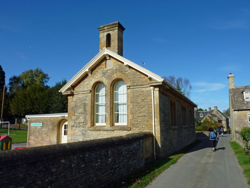
GUTTING POWER CHURCH ROAD SP 0924 (west side) 11/85 School II School: built 1872 under patronage of John Waddingham of Guiting Grange. Rock-faced limestone on ashlar plinth, ashlar quoins and window surrounds also. Slate roof with ashlar chimney and bell surround. Rectangular main body with extension set back slightly on right. Single storey. 3 pairs of round headed windows. Left pair with horizontal glazing bars only. Bell surround from far gable end. Moulded stone and wood eaves cornice with moulded wood and stone brackets at gable ends. Stone eaves cornice extends across gable end as string. Interior not inspected.
Listing NGR: SP0945624700
External links are from the relevant listing authority and, where applicable, Wikidata. Wikidata IDs may be related buildings as well as this specific building. If you want to add or update a link, you will need to do so by editing the Wikidata entry.


Other nearby listed buildings