Latitude: 51.9544 / 51°57'16"N
Longitude: -1.9628 / 1°57'45"W
OS Eastings: 402654
OS Northings: 228440
OS Grid: SP026284
Mapcode National: GBR 3N1.GKS
Mapcode Global: VHB1K.X4QK
Plus Code: 9C3WX23P+QV
Entry Name: Tudor Cottage
Listing Date: 31 October 1984
Grade: II
Source: Historic England
Source ID: 1171998
English Heritage Legacy ID: 134017
ID on this website: 101171998
Location: Winchcombe, Tewkesbury, Gloucestershire, GL54
County: Gloucestershire
District: Tewkesbury
Civil Parish: Winchcombe
Built-Up Area: Winchcombe
Traditional County: Gloucestershire
Lieutenancy Area (Ceremonial County): Gloucestershire
Church of England Parish: Winchcombe St Peter
Church of England Diocese: Gloucester
Tagged with: Cottage
SP 02 28 WINCHCOMBE HAILES STREET (east side) 4/120 No 31 (Tudor - Cottage)
GV II
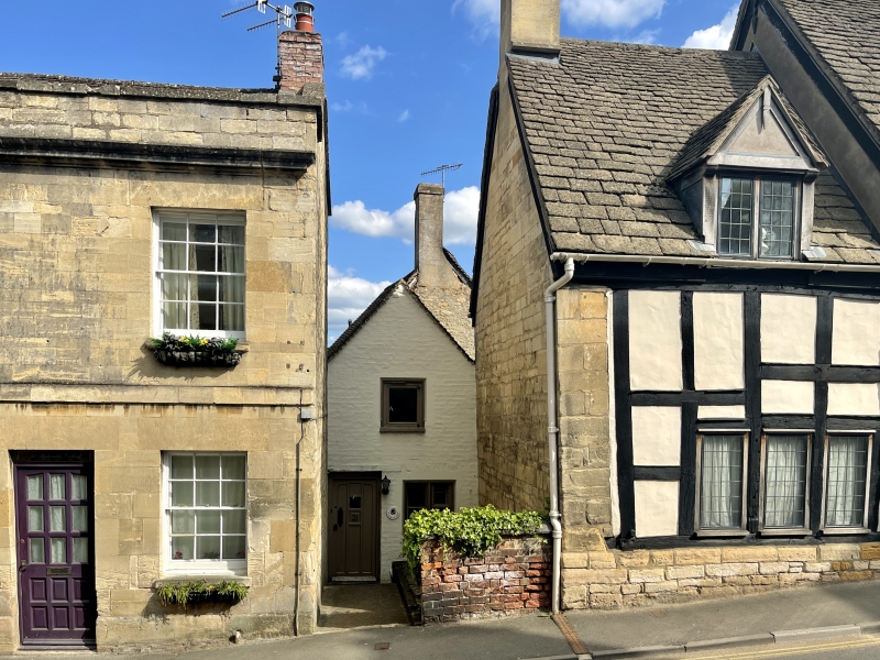
House set back from street. C17. Painted brick, concrete tile narrow gable to street, but more extensive structure in squared limestone behind, including lofty gable stack. Street elevation has single light with chamfered surround in gable, over 2 light splayed chamfer casement ground floor, right, and C20 panelled door, left. Interior: large central stone chimney breast with bressummer fire to central room of three in depth, suspected former bread oven projecting externally, heavy chamfered beams and original floor joists, some chamfered, one single light window in party wall, right, ground floor, and in framed thick rubble stone back wall a large opening, perhaps originally the main entrance. In attic room, back, two exposed purlins in each slope are circular in section.
Listing NGR: SP0265428440
External links are from the relevant listing authority and, where applicable, Wikidata. Wikidata IDs may be related buildings as well as this specific building. If you want to add or update a link, you will need to do so by editing the Wikidata entry.


Other nearby listed buildings