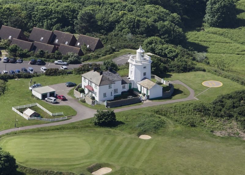
Latitude: 52.9246 / 52°55'28"N
Longitude: 1.3166 / 1°18'59"E
OS Eastings: 623036
OS Northings: 341509
OS Grid: TG230415
Mapcode National: GBR WD3.PP5
Mapcode Global: WHMS3.6R68
Plus Code: 9F43W8F8+VJ
Entry Name: Cromer Lighthouse
Listing Date: 21 January 1977
Grade: II
Source: Historic England
Source ID: 1171781
English Heritage Legacy ID: 222545
ID on this website: 101171781
Location: Suffield Park, North Norfolk, NR27
County: Norfolk
District: North Norfolk
Civil Parish: Cromer
Built-Up Area: Cromer
Traditional County: Norfolk
Lieutenancy Area (Ceremonial County): Norfolk
Church of England Parish: Cromer St Peter and St Paul
Church of England Diocese: Norwich
Tagged with: Lighthouse
OVERSTRAND ROAD 1. 5320 (North East Side) Cromer Lighthouse TG 24 SW 2/49
II
2. Built 1833. Fairly squat octagonal stuccoed tower with cornice balustrade, topped by circular lantern with a wind vane. 3 storeys plus the lantern, on alternate sides of octagon, windows, sashes, some with glazing bars, some blocked. Abutting wing of one storey to east and larger wing to south, both mid to late C19. The original lighthouse was built in 1719 but collapsed with the cliff in the sea in 1866.
Listing NGR: TG2303641509
External links are from the relevant listing authority and, where applicable, Wikidata. Wikidata IDs may be related buildings as well as this specific building. If you want to add or update a link, you will need to do so by editing the Wikidata entry.


Other nearby listed buildings