Latitude: 50.4321 / 50°25'55"N
Longitude: -3.6906 / 3°41'26"W
OS Eastings: 280027
OS Northings: 60505
OS Grid: SX800605
Mapcode National: GBR QL.MCJN
Mapcode Global: FRA 375X.61H
Plus Code: 9C2RC8J5+RQ
Entry Name: The Castle
Listing Date: 14 November 1969
Grade: I
Source: Historic England
Source ID: 1168856
English Heritage Legacy ID: 99088
ID on this website: 101168856
Location: Totnes, South Hams, Devon, TQ9
County: Devon
District: South Hams
Civil Parish: Totnes
Built-Up Area: Totnes
Traditional County: Devon
Lieutenancy Area (Ceremonial County): Devon
Church of England Parish: Totnes St Mary
Church of England Diocese: Exeter
Tagged with: Motte-and-bailey castle Independent museum
1. 5180 CASTLE STREET (East Side) ------------ The Castle SX 8060 NW 1/42 SX 8060 SW 1/42 SX 7960 NE 1/42 14.11.69.
I
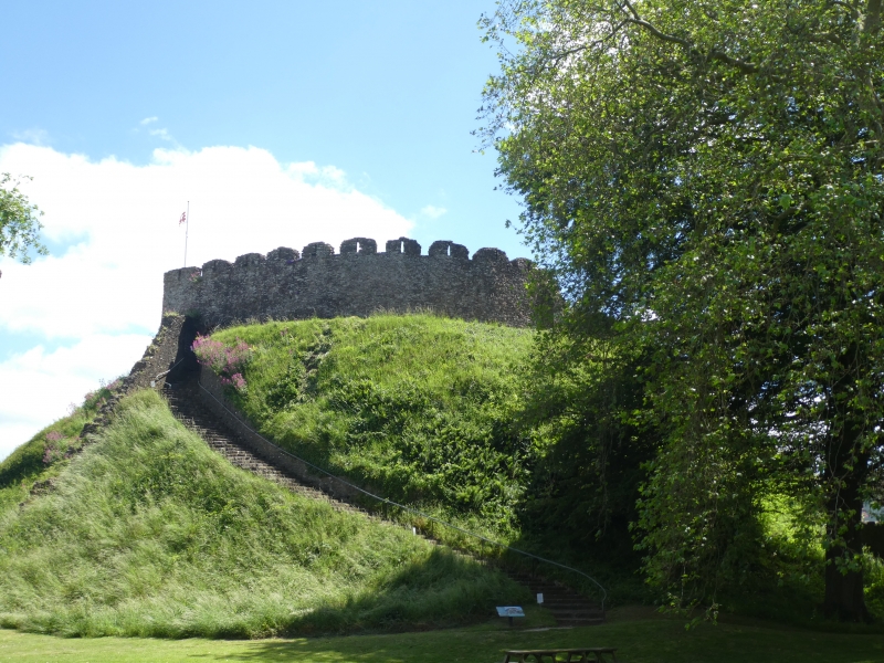
2. A motte and bailey castle, presumably with timber fortifications, was constructed by Judhael of Totnes shortly after the Conquest. It occupied the north-east corner of the Anglo-saxon burgh. The earliest shell-keep, built by Reginald de Braose circa 1219, was extensively rebuilt together with the rest of the castle by Baron Zouche in 1326. The castle was later owned by the Edgecombes of Cothele and the Seymour family, by whom it was placed in the guardianship of the Ministry of Works in 1947. The main function of Totnes castle was to act as a centre for the manorial courts under the constable, and as a base for the administration of the family estates. The earliest remains, apart from the motte and bailey earthworks, are masonry footings on the top of the motte of an Cll or C12 square, timber tower. The surviving upstanding masonry is mostly of C14 date and comprises a circular masonry shell-keep and sections of the bailey curtain wall. Keep of Devonion limestone rubble with red sandstone dressings and battered external face. Crenellated battlements with merlons pierced for loom; approached by 2 stairways in the thickness of the wall. Garderobe chamber also within the thickness of the curtain and projecting beyond the line of the wall; lit by pair of crossed loops. Bailey curtain-wall of pitched limestone rubble. The hall and other domestic buildings which formerly stood in the bailey no longer survive. Flanking the entrance to the site are 2 granite pillars possibly taken from the Exchange built in 1616 and pulled down in 1878. Scheduled Ancient Monument.
Listing NGR: SX8002760505
External links are from the relevant listing authority and, where applicable, Wikidata. Wikidata IDs may be related buildings as well as this specific building. If you want to add or update a link, you will need to do so by editing the Wikidata entry.


Other nearby listed buildings