Latitude: 52.4006 / 52°24'1"N
Longitude: 0.2599 / 0°15'35"E
OS Eastings: 553848
OS Northings: 280462
OS Grid: TL538804
Mapcode National: GBR M6H.DJY
Mapcode Global: VHHJ6.GX8M
Plus Code: 9F42C725+6X
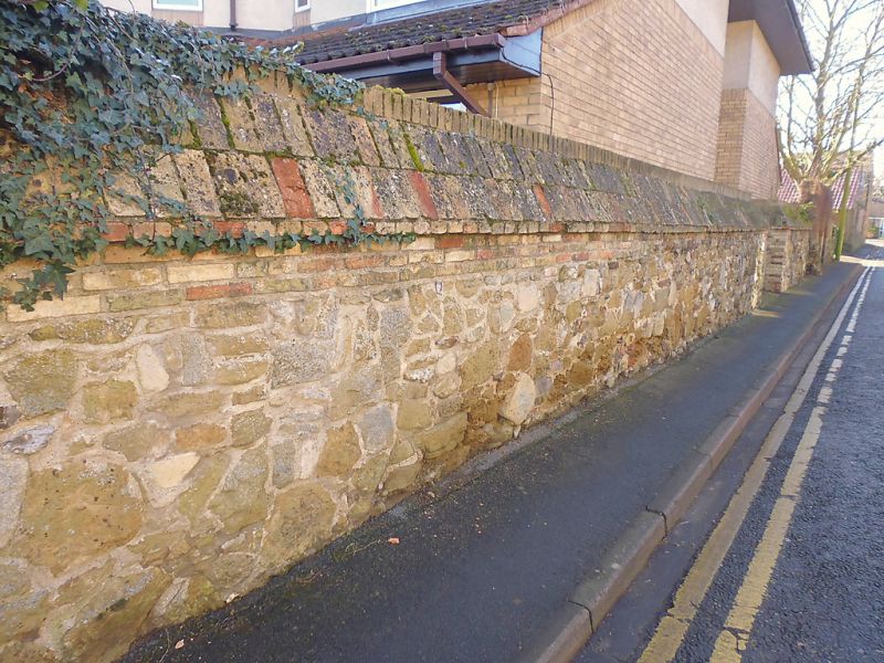
Entry Name: A medieval wall on the south side of Chapel Street
Listing Date: 19 June 1972
Grade: II
Source: Historic England
Source ID: 1167978
English Heritage Legacy ID: 48788
ID on this website: 101167978
Location: Ely, East Cambridgeshire, CB6
County: Cambridgeshire
District: East Cambridgeshire
Civil Parish: Ely
Built-Up Area: Ely
Traditional County: Cambridgeshire
Lieutenancy Area (Ceremonial County): Cambridgeshire
Church of England Parish: Ely
Church of England Diocese: Ely
Tagged with: Wall
This list entry was subjected to a Minor Enhancement on 28 October 2025 to update name, address and details description and reformat the text to current standards
TL 5380
1/195
CHAPEL STREET
A medieval wall on the south side of Chapel Street
(Formerly listed as ST MARY'S STREET (North Side) Wall to No 28)
II
A medieval stone wall, possibly with reused stone, topped later with brick, with a sloping brick capping. The wall extends for approximately 62 yards on the south side of Chapel Street. It originally formed the north boundary to the grounds of No 28 St Mary's Street prior to it being redeveloped with a care home in 1986.
Formerly listed as Wall to Number 28 St Mary's Street.
Listing NGR: TL5384880462
External links are from the relevant listing authority and, where applicable, Wikidata. Wikidata IDs may be related buildings as well as this specific building. If you want to add or update a link, you will need to do so by editing the Wikidata entry.


Other nearby listed buildings