Latitude: 53.9075 / 53°54'26"N
Longitude: -1.9845 / 1°59'4"W
OS Eastings: 401115
OS Northings: 445699
OS Grid: SE011456
Mapcode National: GBR GRL8.51
Mapcode Global: WHB7N.H17T
Plus Code: 9C5WW248+X6
Entry Name: Kildwick Bridge
Listing Date: 10 September 1954
Grade: I
Source: Historic England
Source ID: 1167718
English Heritage Legacy ID: 324743
ID on this website: 101167718
Location: Farnhill, North Yorkshire, BD20
County: North Yorkshire
District: Craven
Civil Parish: Kildwick
Traditional County: Yorkshire
Lieutenancy Area (Ceremonial County): North Yorkshire
Church of England Parish: Kildwick St Andrew
Church of England Diocese: Leeds
Tagged with: Road bridge
SE 04 NW KILDWICK KEIGHLEY ROAD
1/16 Kildwick Bridge
10.9.54
GV I
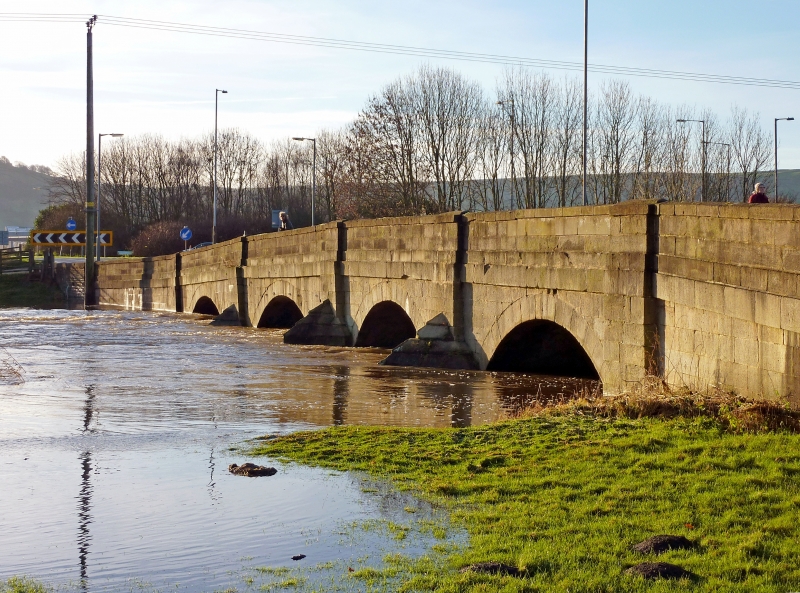
Bridge. 1305 - 1313 for the monks of Bolton Abbey, widened on east side 1780, parapet and flanking walls repaired C19, strengthened 1961. Ashlar with gritstone rubble patching and repairs. 4 arches, pointed cutwaters. West side with medieval work has 2 pointed northern arches and 2 round arches to south. Chamfered voussoirs and 5 deep chamfered ribs to each arch. Projecting band at road level; ridged parapet coping. East side: 4 round arches, projecting band and parapet as west, shallow buttresses rising from the cutwaters. One of the earliest documented medieval bridges, work continuing from 1305 until 1313 with a break during 1311; costs to masons, carters, stone-breakers, are recorded and a lime kiln was constructed in 1308. The bridge carried the main routeway for monks from Bolton Abbey, across the River Aire towards Lancashire. E. Jervoise, Ancient Bridges in the North of England, 1931, p100. R. Mason, Telegraph and Argus, March 15, 1980, article.
Listing NGR: SE0111545699
External links are from the relevant listing authority and, where applicable, Wikidata. Wikidata IDs may be related buildings as well as this specific building. If you want to add or update a link, you will need to do so by editing the Wikidata entry.


Other nearby listed buildings