Latitude: 52.3186 / 52°19'6"N
Longitude: -2.0829 / 2°4'58"W
OS Eastings: 394444
OS Northings: 268945
OS Grid: SO944689
Mapcode National: GBR 2G3.N6R
Mapcode Global: VH923.VZ6G
Plus Code: 9C4V8W98+CR
Entry Name: Bowling Green Farmhouse
Listing Date: 27 November 1986
Grade: II
Source: Historic England
Source ID: 1167401
English Heritage Legacy ID: 156376
ID on this website: 101167401
Location: Stoke Heath, Bromsgrove, Worcestershire, B61
County: Worcestershire
District: Bromsgrove
Civil Parish: Stoke
Built-Up Area: Stoke Prior
Traditional County: Worcestershire
Lieutenancy Area (Ceremonial County): Worcestershire
Tagged with: Farmhouse
SO 96 NW DODFORD WITH GRAFTON CP WORCESTER ROAD (west side)
11/113 Bowling Green Farmhouse
GV II
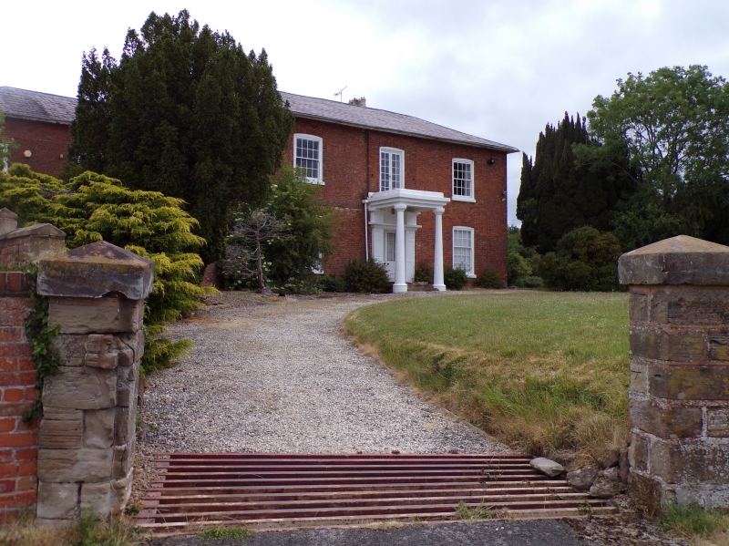
Farmhouse, now house. c1700 on older site; altered and extended early C19 and mid-C20. Brick, partly handmade, on chamfered sandstone plinth; hipped shallow-pitched slate roofs with overhanging eaves and rear stacks. Two storeys and cellar, partly with three-course band between storeys. Three bays; central bay is narrow and breaks forward slightly; windows have cambered heads and moulded architraves; outer bays have 20-pane sashes on ground floor and 16-pane sashes on first floor; central first floor window replaced by C20 glazed double doors in enlarged opening. Central entrance has square moulded flat canopy on slender tapered columns, wide panelled pilasters, panelled reveals and soffit and half-glazed double doors. Above the canopy is an ornate wrought iron balcony. Interior: noted as having retained its C19 ceiling mouldings and dog-leg staircase. Adjoining the left side elevations are the truncated remains of an original large external chimney with offsets. Large range projects to rear left. The left and central bay of the front range and the left part of the rear range is all that survives of the older house. The right bay was added in the C19 to provide a symmetrical front elevation and at the same time the roof was altered and reduced in height and the rear range was extended. The farmhouse was originally part of the Grafton Manor (qv) estate.
Listing NGR: SO9444168950
External links are from the relevant listing authority and, where applicable, Wikidata. Wikidata IDs may be related buildings as well as this specific building. If you want to add or update a link, you will need to do so by editing the Wikidata entry.


Other nearby listed buildings