Latitude: 54.0637 / 54°3'49"N
Longitude: -2.0037 / 2°0'13"W
OS Eastings: 399856
OS Northings: 463089
OS Grid: SD998630
Mapcode National: GBR GPGG.00
Mapcode Global: WHB6W.634Z
Plus Code: 9C6V3X7W+FG
Entry Name: Guide Post at SD 9986 6309
Listing Date: 23 June 1989
Grade: II
Source: Historic England
Source ID: 1167138
English Heritage Legacy ID: 324799
ID on this website: 101167138
Location: Linton, North Yorkshire, BD23
County: North Yorkshire
District: Craven
Civil Parish: Linton
Traditional County: Yorkshire
Lieutenancy Area (Ceremonial County): North Yorkshire
Tagged with: Guidestone Fingerpost Guidestone
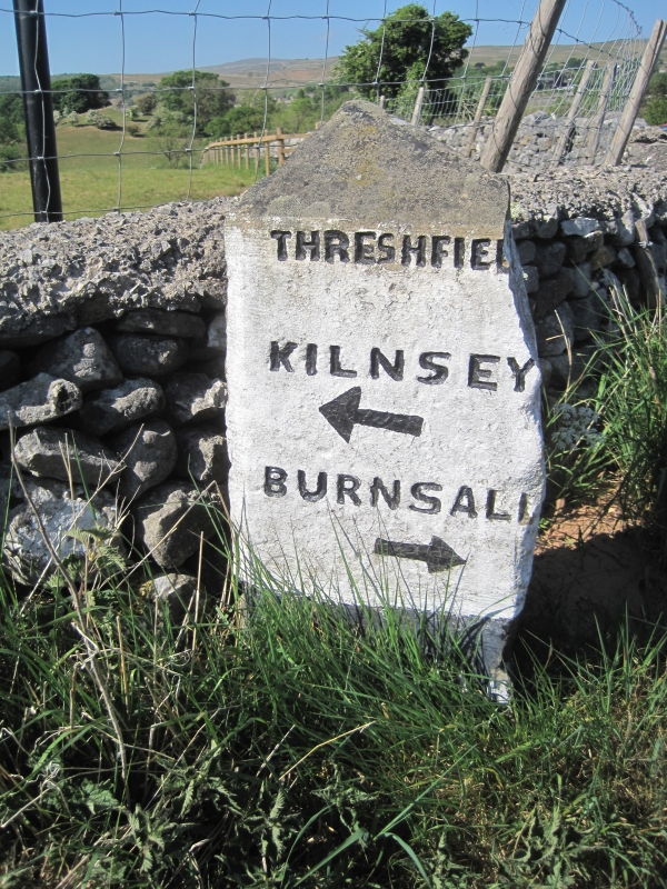
LINTON B6160 SD 9863-9963 (north side) 9/45 Guide Post at SD 9986 6309 II Guide post. Early-mid C19. Gritstone. Triangular in section with pointed top, approximately 2 metres high. Incised capital letters and painted arrows. Left face: "THRESHFIELD/ KILNSEY/ BURNSALL"; right face: "GRASSINGTON/ SKIPTON." The turnpike road along the south-west side of the river Wharfe was begun in the late C18, linking Addingham with the Askrigg turnpike. A. Raistrick, Old Yorkshire Dales, 1967, p171.
Listing NGR: SD9985663088
External links are from the relevant listing authority and, where applicable, Wikidata. Wikidata IDs may be related buildings as well as this specific building. If you want to add or update a link, you will need to do so by editing the Wikidata entry.


Other nearby listed buildings