Latitude: 52.1697 / 52°10'11"N
Longitude: -2.2411 / 2°14'27"W
OS Eastings: 383608
OS Northings: 252414
OS Grid: SO836524
Mapcode National: GBR 1G9.XY9
Mapcode Global: VH92T.3QLJ
Plus Code: 9C4V5Q95+VH
Entry Name: Powick New Bridge
Listing Date: 9 February 1988
Grade: II
Source: Historic England
Source ID: 1166981
English Heritage Legacy ID: 153408
Also known as: New Bridge, Powick
Bridge over River Teme (that part within the City of Worcester)
ID on this website: 101166981
Location: Lower Wick, Malvern Hills, Worcestershire, WR2
County: Worcestershire
District: Malvern Hills
Electoral Ward/Division: Bedwardine
Parish: Powick
Built-Up Area: Worcester
Traditional County: Worcestershire
Lieutenancy Area (Ceremonial County): Worcestershire
Church of England Parish: St John in Bedwardine
Church of England Diocese: Worcester
Tagged with: Road bridge
This asset was previously listed twice also at List Entry 1389991. That entry was removed from the List on 13 August 2024.
This entry was subject to a Minor Amendment on 13 August 2024 to replace it with the text from the more detailed duplicate list entry. The GIS triangle depiction was moved slightly from SO8360852414 to SO8360652415 to centre it on the parish boundary between Powick and the non-parish area of Worcester which passes through the building. The text was reformatted to current standards. The grid reference was removed from the Details text.
POWICK CP
SO 85 SW
3/90
MALVERN ROAD, A 449
Powick New Bridge
GV
II
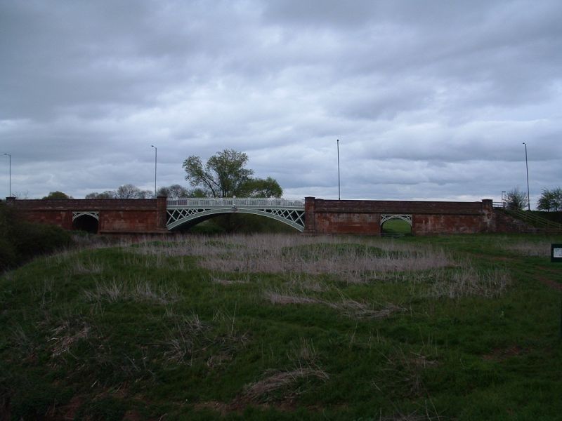
Public road bridge over River Teme. 1837. To a design by William Capper of Birmingham. Contractors for stonework, Mr Faville of Harrogate, for ironwork, Mr Yates of Birmingham. Red sandstone abutments of coursed ashlar. Central span in cast-iron.
Abutments are pierced to right and left of main span over the river to provide through-passage for people/livestock and the relief of flood water. The stonework is of three main sections, plinth, main wall, and parapet separated by moulded string course incorporating a pendant motif moulded into the course of ashlar beneath each string. The stonework is terminated at each end (8 positions) by octagonal piers with engaged columns to each vertical arris. The main span comprises seven similar parallel castings composed of a horizontal element carrying the roadway with a supporting arched element below, the spandrels infilled with lattice-work; the centre of each external arch member carries a shield bearing the City Coat of Arms. The parapet above is of vertical railings of square cross-section, each pair linked at the top to form ogee arches: At centre span is an octagonal column with castellated cap; the railing motif is incorporated into each face of the column casting which also carries the date 1837. The side openings in the abutments are supported by similar, although smaller castings to those in the main span but to a four-centre arch design rather than the single/two-centre arch used centrally.
Historical Notes: "The Trustees of Worcester Turnpikes accepted the tender of Mr Faville of Harrowgate for the stonework for the buttresses etc. of the new iron bridge over the River Teme at Powick. The present bridge will remain for use by occupants of the Mill. The new bridge will be placed approximately 100 yards downstream, the road from the City being altered to lead to it starting between Mr Smith's farm at Wick and The Lion public house and entering the old line again near the brickworks on Lower Ham. The bridge will consist of one arch of 70 foot span and will be 32 feet wide (10 feet wider than the Worcester Bridge) allowing ample space each side for foot passengers. Work to commence forthwith and be completed by the end of the year. Mr Faville will use Arley stone and Mr Yates of Birmingham is the contractor for the ironwork at ,2020, the total cost will be ,6020." ('Herald' May 21st. 1836.) Originally the eight turrets of the bridge had 'gothic' domes on them, removed after a lorry knocked one off in 1950.
External links are from the relevant listing authority and, where applicable, Wikidata. Wikidata IDs may be related buildings as well as this specific building. If you want to add or update a link, you will need to do so by editing the Wikidata entry.


Other nearby listed buildings