Latitude: 54.0671 / 54°4'1"N
Longitude: -2.275 / 2°16'29"W
OS Eastings: 382101
OS Northings: 463502
OS Grid: SD821635
Mapcode National: GBR DPKD.8S
Mapcode Global: WHB6R.01YD
Plus Code: 9C6V3P8G+V2
Entry Name: Milestone
Listing Date: 13 September 1988
Grade: II
Source: Historic England
Source ID: 1166728
English Heritage Legacy ID: 324316
ID on this website: 101166728
Location: Settle, North Yorkshire, BD24
County: North Yorkshire
District: Craven
Civil Parish: Settle
Built-Up Area: Settle
Traditional County: Yorkshire
Lieutenancy Area (Ceremonial County): North Yorkshire
Church of England Parish: Settle Holy Ascension
Church of England Diocese: Leeds
Tagged with: Milestone
SD 8263
11/16
SETTLE
HIGHWAY
(west side)
Milestone
GV
II
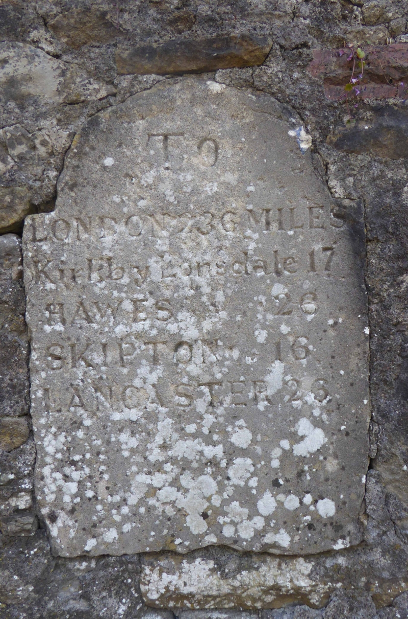
Milestone situated on pre-turnpike route into Settle. Early C19. Stone;
c.60 cm high. Round head. Inscribed:
TO
LONDON 236 MILES
Kirkby Lonsdale 17
HAWES 26
SKIPTON 16
LANCASTER 26
Listing NGR: SD8210163502
External links are from the relevant listing authority and, where applicable, Wikidata. Wikidata IDs may be related buildings as well as this specific building. If you want to add or update a link, you will need to do so by editing the Wikidata entry.


Other nearby listed buildings