Latitude: 52.4479 / 52°26'52"N
Longitude: -0.1078 / 0°6'28"W
OS Eastings: 528691
OS Northings: 285014
OS Grid: TL286850
Mapcode National: GBR K2R.HK4
Mapcode Global: VHGLC.2QVS
Plus Code: 9C4XCVXR+5V
Entry Name: 49, High Street
Listing Date: 8 June 1983
Grade: II
Source: Historic England
Source ID: 1166582
English Heritage Legacy ID: 54461
ID on this website: 101166582
Location: Ramsey, Huntingdonshire, Cambridgeshire, PE26
County: Cambridgeshire
District: Huntingdonshire
Civil Parish: Ramsey
Built-Up Area: Ramsey
Traditional County: Huntingdonshire
Lieutenancy Area (Ceremonial County): Cambridgeshire
Church of England Parish: Ramsey St Thomas a Becket
Church of England Diocese: Ely
Tagged with: Building
TL 2886-2986 RAMSEY HIGH STREET 11/27 (south side)
No 49 GV II
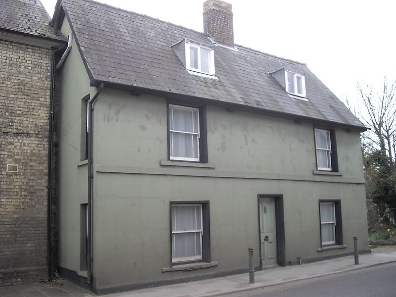
Early C18 house. Two storeys and attics. Rendered brick with imitation masonry joints. Steeply pitched roof, slated and tiled with hipped roof to rear stair turret. Ridge stack. Band between floors. Two flat roofed dormer windows. Boarded eaves with paired modillions. Two recessed hung sash windows with glazing bars at both floor levels in flat arches. Central 4 panelled door.
Listing NGR: TL2869185014
External links are from the relevant listing authority and, where applicable, Wikidata. Wikidata IDs may be related buildings as well as this specific building. If you want to add or update a link, you will need to do so by editing the Wikidata entry.


Other nearby listed buildings