Latitude: 52.8131 / 52°48'47"N
Longitude: -0.3647 / 0°21'52"W
OS Eastings: 510317
OS Northings: 325205
OS Grid: TF103252
Mapcode National: GBR GV9.QLX
Mapcode Global: WHGL6.CKL8
Plus Code: 9C4XRJ7P+64
Entry Name: Stables and Outbuilings at Haconby Hall
Listing Date: 22 January 1987
Grade: II
Source: Historic England
Source ID: 1165869
English Heritage Legacy ID: 194330
ID on this website: 101165869
Location: Haconby, South Kesteven, Lincolnshire, PE10
County: Lincolnshire
District: South Kesteven
Civil Parish: Haconby
Traditional County: Lincolnshire
Lieutenancy Area (Ceremonial County): Lincolnshire
Church of England Parish: Hacconby St Andrew
Church of England Diocese: Lincoln
Tagged with: Stable
HACONBY HALL LANE TF 12 NW (south side) 7/116 Stables and outbuildings at Haconby Hall G.V. II
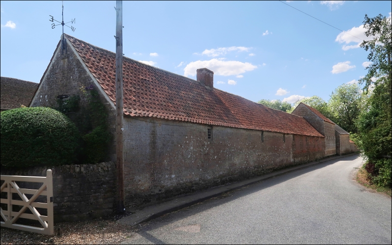
Range of stables and outbuildings. C17, late C18, early C19, C20. Coursed limestone rubble, red brick. Pantile roofs with single ridge stack. C17 single storey 5 bay outbuilding to east, remodelled in C19 and C20, with doorway to right with plank door, a 3 light casement to left with a C20 garage door beyond. 2 doorways with plank doors to left. All the openings with wooden lintels. Early C19 6 bay stables attached to left with 3 brick dressed doorways with double stable doors and fixed glazing bar windows immediately above, alternate with 3 brick dressed, partly shuttered windows with wooden lintels. 2 storey stable attached to left of 3 bays with central doorway flanked by single fixed windows, all with raised keystones and with 3 shuttered openings above. Lower 2 bay stable attached to left with double stable doors and wooden lintel, window to left with stone lintel, and single shuttered opening above.
Listing NGR: TF1031725205
External links are from the relevant listing authority and, where applicable, Wikidata. Wikidata IDs may be related buildings as well as this specific building. If you want to add or update a link, you will need to do so by editing the Wikidata entry.


Other nearby listed buildings