Latitude: 51.954 / 51°57'14"N
Longitude: 0.3414 / 0°20'29"E
OS Eastings: 560996
OS Northings: 230974
OS Grid: TL609309
Mapcode National: GBR NFB.H4S
Mapcode Global: VHHLK.V4WY
Plus Code: 9F32X83R+HH
Entry Name: Almshouses
Listing Date: 20 February 1967
Last Amended: 28 June 1983
Grade: II
Source: Historic England
Source ID: 1165533
English Heritage Legacy ID: 122297
ID on this website: 101165533
Location: Thaxted, Uttlesford, Essex, CM6
County: Essex
District: Uttlesford
Civil Parish: Thaxted
Built-Up Area: Thaxted
Traditional County: Essex
Lieutenancy Area (Ceremonial County): Essex
Tagged with: Almshouse
1. THAXTED CHURCHYARD Nos l, 2 and 3 (Almshouses) (formerly listed as W range of almshouses) TL 63SW: 5/15 20.2.67
GV II
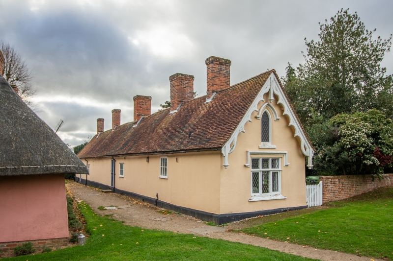
2. C17 extensively altered in C19. Timber framed and plastered with red plain tile roof, hipped at south end. I storey and attics. 7 gabled dormers to rear. Decorative pierced bargeboards with pendants, at north end, above lancet headed window, and square mullion and transom window with moulded label. Gabled dormer at south end. Red brick chimney stacks.
Listing NGR: TL6099630974
External links are from the relevant listing authority and, where applicable, Wikidata. Wikidata IDs may be related buildings as well as this specific building. If you want to add or update a link, you will need to do so by editing the Wikidata entry.


Other nearby listed buildings