Latitude: 52.1503 / 52°9'0"N
Longitude: 0.0548 / 0°3'17"E
OS Eastings: 540681
OS Northings: 252211
OS Grid: TL406522
Mapcode National: GBR L7Z.2NN
Mapcode Global: VHHKF.W6TY
Plus Code: 9F425323+4W
Entry Name: The Maltings
Listing Date: 6 August 1970
Grade: II
Source: Historic England
Source ID: 1163336
English Heritage Legacy ID: 51794
ID on this website: 101163336
Location: Haslingfield, South Cambridgeshire, CB23
County: Cambridgeshire
District: South Cambridgeshire
Civil Parish: Haslingfield
Built-Up Area: Haslingfield
Traditional County: Cambridgeshire
Lieutenancy Area (Ceremonial County): Cambridgeshire
Church of England Parish: Haslingfield All Saints
Church of England Diocese: Ely
Tagged with: Architectural structure
TL 4052 HASLINGFIELD HIGH STREET (North Side) 15/178 No. 39 (The 6.8.1970 Maltings) II
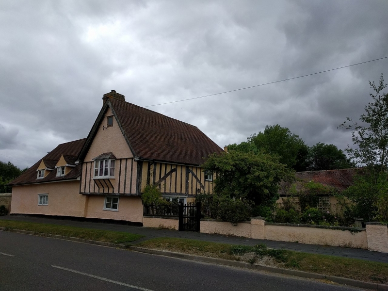
House. Late C15 or early C16. Timber-framed, part exposed but mainly rendered with roughcast. Cement tiled roofs hipped to rear of crosswing, and late C17 or early C18 ridge stack. Plan of open-hall with parlour crosswing and floor and stack inserted in C17. Hall of one storey and attic. One dormer and one window to front elevation. Crosswing of three bays and two storeys and attic. First floor jettied. Some applied framing to the end to the road and boxed jetty beam on original brackets. Small casement to attic above C20 oriel window. Side elevation has original exposed framing at first floor. Curved downward bracing. At the rear is a range of buildings associated with industries and includes a two-bay barn with a pit. Adjoining the house is a late C17 red brick wall. Alternating courses of stretchers and Flemish bond. Probably associated with the building campaign of Sir Thomas Wendy in 1673. Inside. There is evidence of an open hall in the west range, including smoke blackening in the roof and a gablet formerly in the gable end. Windows can be inferred, one with diamond mullions and two with shutter grooving. R.C.H.M. West Cambs., mon.(6) Plate 98
Listing NGR: TL4068152211
External links are from the relevant listing authority and, where applicable, Wikidata. Wikidata IDs may be related buildings as well as this specific building. If you want to add or update a link, you will need to do so by editing the Wikidata entry.


Other nearby listed buildings