Latitude: 52.2719 / 52°16'18"N
Longitude: 0.2937 / 0°17'37"E
OS Eastings: 556595
OS Northings: 266223
OS Grid: TL565662
Mapcode National: GBR M82.H1Y
Mapcode Global: VHHK0.15L7
Plus Code: 9F4277CV+PF
Entry Name: Myster House
Listing Date: 31 January 1984
Grade: II
Source: Historic England
Source ID: 1162413
English Heritage Legacy ID: 49063
ID on this website: 101162413
Location: Reach, East Cambridgeshire, CB25
County: Cambridgeshire
District: East Cambridgeshire
Civil Parish: Reach
Built-Up Area: Reach
Traditional County: Cambridgeshire
Lieutenancy Area (Ceremonial County): Cambridgeshire
Church of England Parish: Burwell with Reach
Church of England Diocese: Ely
Tagged with: House
TL 5666 REACH HIGH STREET (south-west side)
13/148 Myster House
GV II
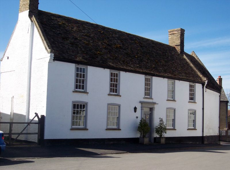
House, formerly the Swan Inn. Late C17 with five 'bays' of street facade refronted in early C19. Local red brick coursed in English bond with clunch rubble infill. Slate roof to street, plain tile to rear. Parapet gables with C19 brick copings and end stacks. Two storeys with original cellar to south-east. Rear wing late C18 of one storey and attic extended as stables and barn. Five first floor twelve-paned hung sash windows in flush wooden frames, and four ground floor windows with sixteen panes. Wooden architrave to C19 four panelled door with rectangular fanlight. Interior; C19 staircase in cross-passage of hall with rear door blocked. Sealed inglenook hearth to hall. Jewel stops to chamfered ceiling beams. Cellar floor joists rebated for boards; C19 external entry to cellar replaces original entry within house.
RCHM, North-East Cambridgeshire, p.87, mon.14
Listing NGR: TL5659566223
External links are from the relevant listing authority and, where applicable, Wikidata. Wikidata IDs may be related buildings as well as this specific building. If you want to add or update a link, you will need to do so by editing the Wikidata entry.


Other nearby listed buildings