Latitude: 50.2334 / 50°14'0"N
Longitude: -5.2228 / 5°13'21"W
OS Eastings: 170264
OS Northings: 42019
OS Grid: SW702420
Mapcode National: GBR Z3.DK4H
Mapcode Global: VH12K.FD8D
Plus Code: 9C2P6QMG+9V
Entry Name: The Count House
Listing Date: 12 September 1989
Grade: II
Source: Historic England
Source ID: 1161942
English Heritage Legacy ID: 66845
ID on this website: 101161942
Location: Redruth, Cornwall, TR15
County: Cornwall
Civil Parish: Redruth
Built-Up Area: Redruth
Traditional County: Cornwall
Lieutenancy Area (Ceremonial County): Cornwall
Church of England Parish: Redruth
Church of England Diocese: Truro
Tagged with: House
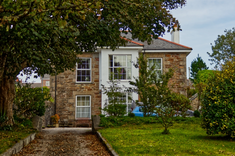
REDRUTH PEDN-AN-DREA SW 64 SE 6/285 The Count House GV II Count house to former Pedn-an-drea Mine, now private dwelling. 1770's, altered in C19. Killas rubble brought to courses, with granite quoins and dressings, slate roof, brick chimneys. Rectangular plan, but with added porch to front. Two storeys and 3 bays, symmetrical; central doorway now covered by added 2-storey porch which is rendered and painted white and has a door in the left side, a large altered window on each floor of the front, and a hipped roof; 2 large 12-pane sashed windows on each floor; 2-span hipped roof with projecting eaves. Rear has inter alia a round-headed stair window with radiating glazing bars. Interior: 4-room plan with central passage; hatch window between front and back rooms on right-hand side said to have been pay window.
Listing NGR: SW7026442019
External links are from the relevant listing authority and, where applicable, Wikidata. Wikidata IDs may be related buildings as well as this specific building. If you want to add or update a link, you will need to do so by editing the Wikidata entry.


Other nearby listed buildings