Latitude: 52.5721 / 52°34'19"N
Longitude: -0.2464 / 0°14'46"W
OS Eastings: 518943
OS Northings: 298582
OS Grid: TL189985
Mapcode National: GBR HZP.QK9
Mapcode Global: WHHNK.5MY1
Plus Code: 9C4XHQC3+RF
Entry Name: 55, Priestgate
Listing Date: 7 February 1952
Grade: II
Source: Historic England
Source ID: 1161813
English Heritage Legacy ID: 49689
ID on this website: 101161813
Location: Peterborough, Cambridgeshire, PE1
County: City of Peterborough
Electoral Ward/Division: Central
Parish: Non Civil Parish
Built-Up Area: Peterborough
Traditional County: Northamptonshire
Lieutenancy Area (Ceremonial County): Cambridgeshire
Church of England Parish: Peterborough St John the Baptist
Church of England Diocese: Peterborough
Tagged with: Building
1.
1500
TL 1898 NE
4/25
7.2.52
PETERBOROUGH
PRIESTGATE
(North Side)
No 55
II
GV
2.
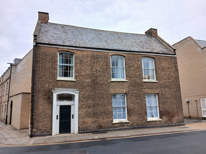
C18, Brick, part rubble to side. Welsh slate roof. 2 storeys and attics.
3 flat topped dormers, slate hung sides, casements. Wood eaves cornice.
Overhanging eaves. On 1st floor, 3 windows, segmental gauged brick arches.
On ground floor, 2 flat arched windows. 2-panel door, half glazed, set back
in wood and glazed surround, rectangular fanlight. Moulded segmental architrave.
Some panelling in entrance hall.
Nos 43, 45, 49, 51 & 55 form a group.
Listing NGR: TL1894398582
External links are from the relevant listing authority and, where applicable, Wikidata. Wikidata IDs may be related buildings as well as this specific building. If you want to add or update a link, you will need to do so by editing the Wikidata entry.


Other nearby listed buildings