Latitude: 52.2304 / 52°13'49"N
Longitude: -0.565 / 0°33'54"W
OS Eastings: 498100
OS Northings: 260108
OS Grid: SP981601
Mapcode National: GBR DZK.1ZC
Mapcode Global: VHFPT.564G
Plus Code: 9C4X6CJM+5X
Entry Name: Colworth House
Listing Date: 7 May 1952
Grade: II*
Source: Historic England
Source ID: 1160878
English Heritage Legacy ID: 37201
Also known as: Colworth Manor
ID on this website: 101160878
Location: Bedford, Bedfordshire, MK44
County: Bedford
Civil Parish: Sharnbrook
Traditional County: Bedfordshire
Lieutenancy Area (Ceremonial County): Bedfordshire
Church of England Parish: Sharnbrook
Church of England Diocese: St.Albans
Tagged with: English country house Manor estate
SHARNBROOK COLWORTH ESTATE SP 965E 2/450 Colworth House 7.5.52 - II*
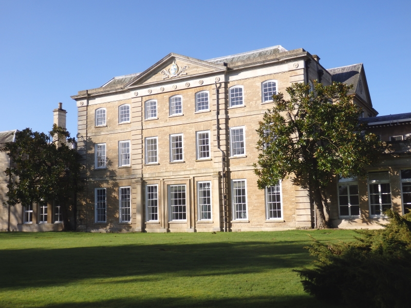
Country house with compact main wing of 1714-20, replacement side wings with link blocks of 1770s, linked outbuildings of 1811 and 1890s, rear elevations altered 1890s. Coursed limestone and ashlar, slate roofs. Main wing of three storeys: garden front of three bays with ashlar quoins, central of three windows breaking forward slightly, side ones each of two windows. Pediment of 1770 over central bay with Lee motto and arms; frieze with patera, dentil course. Second floor has segmental headed windows, first and ground floor square-headed, the latter taller; all sashes with glazing bars. Single storey link blocks to two storey side wings: L.H. has three first floor windows and two ground floor ones flanking large square bay window. R.H. has four windows each floor. At extreme R.H. is pair of single storey outbuildings with central archway similar to that at Twin Lodges. Interior of main wing mostly converted for offices, but neo-Rococo staircase of 1811 survives.
Listing NGR: SP9810060108
External links are from the relevant listing authority and, where applicable, Wikidata. Wikidata IDs may be related buildings as well as this specific building. If you want to add or update a link, you will need to do so by editing the Wikidata entry.


Other nearby listed buildings