Latitude: 54.5799 / 54°34'47"N
Longitude: -1.8096 / 1°48'34"W
OS Eastings: 412401
OS Northings: 520537
OS Grid: NZ124205
Mapcode National: GBR HHTH.00
Mapcode Global: WHC5L.54JT
Plus Code: 9C6WH5HR+X4
Entry Name: 46 and 47, North Green
Listing Date: 14 September 1966
Last Amended: 30 September 1987
Grade: II
Source: Historic England
Source ID: 1160695
English Heritage Legacy ID: 111534
ID on this website: 101160695
Location: Staindrop, County Durham, DL2
County: County Durham
Civil Parish: Staindrop
Built-Up Area: Staindrop
Traditional County: Durham
Lieutenancy Area (Ceremonial County): County Durham
Church of England Parish: Staindrop
Church of England Diocese: Durham
Tagged with: Building
STAINDROP NORTH GREEN NZ 1220 (North side) 17/169 Nos. 46 and 47 14/9/66 (formerly listed as Nos. 45, 46 and 47)
GV II
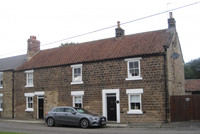
2 houses. Circa 1800. Coursed squared sandstone with painted ashlar dressings and right end quoins; pantiled roof with stone gable coping, 2 storeys, 3 wide bays. Former paired doors between first and second windows have right door blocked and lintel and jambs removed; remaining battened boarded door and 2-pane overlight under flat stone lintel. Similar door and plain overlight in plain stone surround between second and third windows. Late C19 sashes have flat stone lintels and projecting stone sills. Roof has swept eaves; right end gable coping on moulded kneeler; banded ridge chimneys at right of second bay and at right end.
Listing NGR: NZ1240720536
External links are from the relevant listing authority and, where applicable, Wikidata. Wikidata IDs may be related buildings as well as this specific building. If you want to add or update a link, you will need to do so by editing the Wikidata entry.


Other nearby listed buildings