Latitude: 51.6575 / 51°39'27"N
Longitude: -0.8555 / 0°51'19"W
OS Eastings: 479263
OS Northings: 196036
OS Grid: SU792960
Mapcode National: GBR C3H.0JM
Mapcode Global: VHDVX.4L2P
Plus Code: 9C3XM45V+2Q
Entry Name: Ashridge Farmhouse
Listing Date: 4 July 1985
Grade: II
Source: Historic England
Source ID: 1160621
English Heritage Legacy ID: 46618
ID on this website: 101160621
Location: The City, Buckinghamshire, HP14
County: Buckinghamshire
Civil Parish: Radnage
Built-Up Area: The City
Traditional County: Buckinghamshire
Lieutenancy Area (Ceremonial County): Buckinghamshire
Church of England Parish: Radnage
Church of England Diocese: Oxford
Tagged with: Farmhouse
SU 79 NE
2/139
RADNAGE
GREEN END ROAD
Ashridge Farmhouse
II
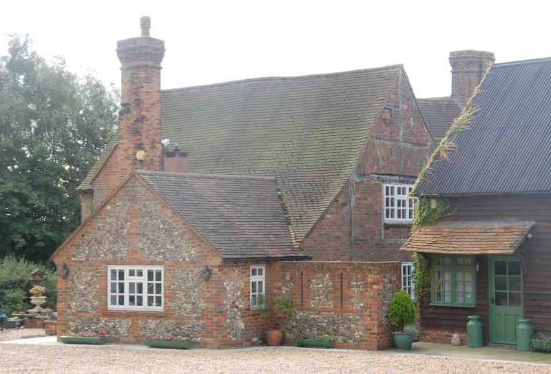
House. Late C17, altered. Timber framing with brick infill to
first floor, the centre bay with some herringbone patterning, the gabled
left bay rendered; ground floor rebuilt in brick; rear part of cross
wing rebuilt in flint with thin brick dressings. C20 tile roofs,
rebuilt chimneys of thin brick with off-set heads. L-plan with
later staircase in rear angle. Cross wing to left is of 2 storeys
with C20 tilting casements. Centre bay has one storey and an attic,
with 3-light barred wooden casement to ground floor and similar 2-light
above in gabled eaves-line dormer. Right bay rebuilt or added c.1800,
of flint and brick with hipped roof and C20 porch. C20 lean-to to left.
Interior shows more timber framing, with steep curved wind-braces and
stop-chamfered spine beam in centre bay. Main fireplace to right of
centre bay has C19 surround with fine gun-rack.
RCHM I p.275 MON.7.
Listing NGR: SU7926396036
External links are from the relevant listing authority and, where applicable, Wikidata. Wikidata IDs may be related buildings as well as this specific building. If you want to add or update a link, you will need to do so by editing the Wikidata entry.


Other nearby listed buildings