Latitude: 50.2191 / 50°13'8"N
Longitude: -5.2885 / 5°17'18"W
OS Eastings: 165507
OS Northings: 40628
OS Grid: SW655406
Mapcode National: GBR FXB3.6CS
Mapcode Global: VH12J.9R1F
Plus Code: 9C2P6P96+JH
Entry Name: 27 and 29, Roskear
Listing Date: 12 September 1989
Grade: II
Source: Historic England
Source ID: 1159940
English Heritage Legacy ID: 66633
ID on this website: 101159940
Location: Tuckingmill, Cornwall, TR14
County: Cornwall
Civil Parish: Camborne
Built-Up Area: Camborne
Traditional County: Cornwall
Lieutenancy Area (Ceremonial County): Cornwall
Church of England Parish: Camborne and Tuckinghill
Church of England Diocese: Truro
Tagged with: Building
CAMBORNE ROSKEAR SW 64 SE (north side) 5/87 Nos.27 and 29 GV II
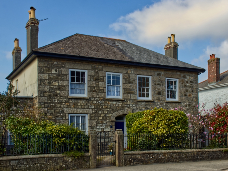
Pair of semi-detached houses. Mid to later C19. Granite rubble brought to courses (No.29 now ribbon-pointed), with granite quoins and dressings, sides and rear rendered; asbestos tile roof with rendered brick chimneys. Rectangular double-depth halls-adjoining plan, each house single-fronted but with a small side wing. Two storeys and 2+2 bays, symmetrical; central coupled doorways with panelled doors set within a basket-arched recessed joint porch with splayed voussoirs and large keystone; 4-pane unhorned sashed windows with exposed boxes and quoined surrounds. Hipped roof with side-wall chimneys. Set back at each end is a small single-storey wing, each with a door and a window (that to No.29 blocked). Rear wall under short carried-down roof. Interior not inspected. Forms group with Nos.21 and 23 and No.25 to left (q.v.).
Listing NGR: SW6550740628
External links are from the relevant listing authority and, where applicable, Wikidata. Wikidata IDs may be related buildings as well as this specific building. If you want to add or update a link, you will need to do so by editing the Wikidata entry.


Other nearby listed buildings