Latitude: 54.7653 / 54°45'55"N
Longitude: -1.4485 / 1°26'54"W
OS Eastings: 435583
OS Northings: 541289
OS Grid: NZ355412
Mapcode National: GBR LFBB.6K
Mapcode Global: WHD5X.QHF6
Plus Code: 9C6WQH82+4J
Entry Name: Ludworth Tower
Listing Date: 28 February 1952
Last Amended: 14 January 1988
Grade: II
Source: Historic England
Source ID: 1159823
English Heritage Legacy ID: 110032
ID on this website: 101159823
Location: Ludworth, County Durham, DH6
County: County Durham
Civil Parish: Shadforth
Traditional County: Durham
Lieutenancy Area (Ceremonial County): County Durham
Church of England Parish: Shadforth and Sherburn
Church of England Diocese: Durham
SHADFORTH LUDWORTH NZ 34 SE 8/41 Ludworth Tower 28/2/52 (Formerly listed as Ludworth Tower remains at Tower Farm) II
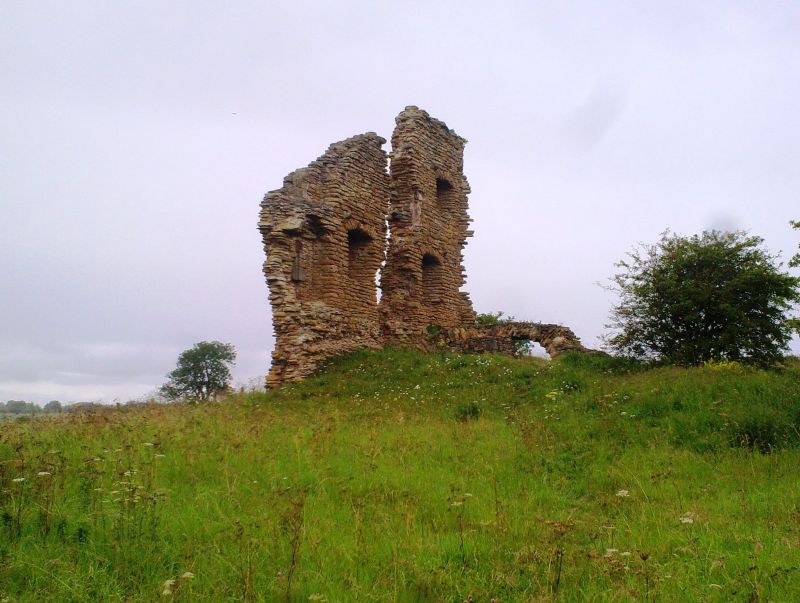
Ruins of tower house. Early C15. (1422 licence to crenellate to Thomas Holden). Thin courses of ochre-coloured limestone, and some magnesian limestone, with sandstone quoins. West elevation: 2 fragments of only surviving wall, to height of 3 storeys with central gap, have 2 roughly- rectangular first-floor window openings, and one on second floor, with dressings removed. East elevation shows rough stone voussoirs over deeply- splayed jambs of these openings; fragments of first-floor fire hood at side of gap, with apparent nook shaft. Fragment of stone spiral stair at north. Remains of barrel-vaulted ground-floor chamber. Fragments formerly identified to south of road now covered over or dispersed. Source W. Hutchinson, The History and Antiquities of the County Palatine of Durham, 1785, 3 vols; II 586.
Listing NGR: NZ3558341289


Other nearby listed buildings