Latitude: 54.5244 / 54°31'27"N
Longitude: -1.5533 / 1°33'11"W
OS Eastings: 429010
OS Northings: 514442
OS Grid: NZ290144
Mapcode National: GBR KJL3.JW
Mapcode Global: WHC5X.3JLV
Plus Code: 9C6WGCFW+QM
Entry Name: Wall
Listing Date: 6 September 1977
Grade: II
Source: Historic England
Source ID: 1159777
English Heritage Legacy ID: 110558
ID on this website: 101159777
Location: Darlington, County Durham, DL1
County: Darlington
Electoral Ward/Division: Park East
Parish: Non Civil Parish
Built-Up Area: Darlington
Traditional County: Durham
Lieutenancy Area (Ceremonial County): County Durham
Church of England Parish: Darlington St Cuthbert
Church of England Diocese: Durham
Tagged with: Churchyard wall
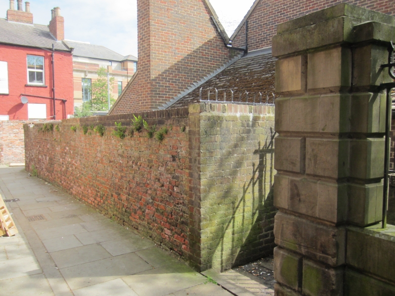
CHURCH LANE 1. (South Side) 5195 wall to north-west of Churchyard (Approx. 30yds in length) NZ 2914 10/227
II
2. C16 or early C17 length of wall, curving around the north-west part of churchyard. Very rough, narrow old brick of brilliant red in a bond of 4 stretcher courses alternating with a header course interspersed by stretchers.
Listing NGR: NZ2901014443
External links are from the relevant listing authority and, where applicable, Wikidata. Wikidata IDs may be related buildings as well as this specific building. If you want to add or update a link, you will need to do so by editing the Wikidata entry.


Other nearby listed buildings