Latitude: 50.1356 / 50°8'8"N
Longitude: -5.4666 / 5°27'59"W
OS Eastings: 152374
OS Northings: 31928
OS Grid: SW523319
Mapcode National: GBR DXWB.2T1
Mapcode Global: VH12T.6VDD
Plus Code: 9C2P4GPM+79
Entry Name: Gwallon Farmhouse
Listing Date: 9 October 1987
Grade: II
Source: Historic England
Source ID: 1159361
English Heritage Legacy ID: 69903
ID on this website: 101159361
Location: Gwallon, Cornwall, TR17
County: Cornwall
Civil Parish: Marazion
Traditional County: Cornwall
Lieutenancy Area (Ceremonial County): Cornwall
Church of England Parish: Marazion
Church of England Diocese: Truro
Tagged with: Farmhouse
MARAZION SW 53 SW
1/1 Gwallon Farmhouse
- II
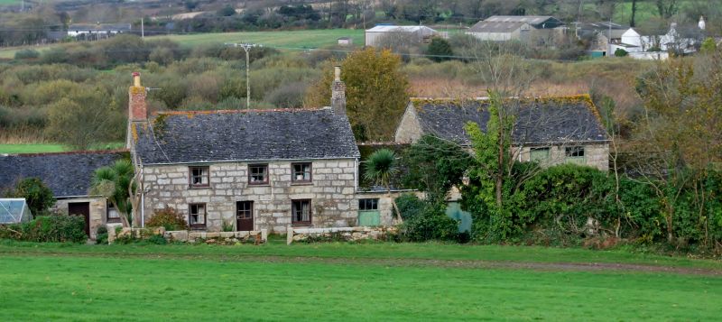
Farmhouse. C18. Granite rubble with granite ashlar to first floor of front, dressed granite quoins, jambstones and ground floor lintels, slate sills. Grouted scantle slate roof with chimneys over the gable ends; brick chimney, left, and dressed granite chimney, right, with brick shaft. Plan: 2 rooms with kitchen/living room left and parlour on slightly lower ground, right. 2 storeys. Slightly irregular 3 window south front with the doorway left of middle and the first floor window over offset towards right. Circa mid C20 door in reduced opening; C20 4-pane horned sashes (formerly horizontal-sliding sashes). Ground floor openings taller, the right hand opening may have been used as a doorway. Interior not inspected. Unusually there is granite ashlar to first floor only, possibly a later C18 remodelling of an earlier C18 front.
Listing NGR: SW5237431928
External links are from the relevant listing authority and, where applicable, Wikidata. Wikidata IDs may be related buildings as well as this specific building. If you want to add or update a link, you will need to do so by editing the Wikidata entry.


Other nearby listed buildings