Latitude: 50.2107 / 50°12'38"N
Longitude: -5.3008 / 5°18'2"W
OS Eastings: 164592
OS Northings: 39736
OS Grid: SW645397
Mapcode National: GBR FX94.0Q1
Mapcode Global: VH12J.2YKV
Plus Code: 9C2P6M6X+7M
Entry Name: St Clair
Listing Date: 1 December 1951
Grade: II
Source: Historic England
Source ID: 1159296
English Heritage Legacy ID: 66563
ID on this website: 101159296
Location: Camborne, Cornwall, TR14
County: Cornwall
Civil Parish: Camborne
Built-Up Area: Camborne
Traditional County: Cornwall
Lieutenancy Area (Ceremonial County): Cornwall
Church of England Parish: Camborne and Tuckinghill
Church of England Diocese: Truro
Tagged with: Architectural structure
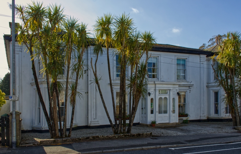
CAMBORNE BASSET ROAD SW 63 NW (west side) 10/18 1.12.51 No.30 and 32 (St.Clair) GV II House, now rest home. Mid C19. Stucco, presumably on rubble, slate roof. Long double-depth plan. Two storeys, 1:3:1 bays, symmetrical, the centre breaking forwards slightly; panelled pilasters with foliated capitals. The central entrance has a rectangular porch mounted on 2 steps, with small matching pilasters framing the door and the narrow side windows, moulded entablature (breaking forwards over the door), and a dentilled cornice; the door has 2 round-headed lights with low panels below and an overlight above, and the side windows are in matching style, with a wreath above each. All the windows are 4-pane sashes with moulded architraves which have egg-and-dart decoration, those flanking the door have cornices on consoles, and those in the 1st and 5th bays are set in prominent 2-storey canted bays with cornices at mid level. Projecting eaves cornice, hipped roof with decorative iron finials over the canted bays, chimneys behind the ridge of the 1st bay and at its left side wall Rear: inter alia a canted bay window, and a stairwindow with intersecting tracery; modern sun lounge not of special interest. Interior: doglegged staircase with open string, scrolled brackets, slender turned balusters and mahogany handrail with wreathed curtail.
Listing NGR: SW6459239736
External links are from the relevant listing authority and, where applicable, Wikidata. Wikidata IDs may be related buildings as well as this specific building. If you want to add or update a link, you will need to do so by editing the Wikidata entry.


Other nearby listed buildings