Latitude: 53.3283 / 53°19'41"N
Longitude: -1.6581 / 1°39'29"W
OS Eastings: 422870
OS Northings: 381316
OS Grid: SK228813
Mapcode National: GBR JYVY.TM
Mapcode Global: WHCCN.HLNV
Plus Code: 9C5W88HR+8Q
Entry Name: Railway Viaduct
Listing Date: 19 February 1985
Grade: II
Source: Historic England
Source ID: 1158868
English Heritage Legacy ID: 81195
Also known as: Hathersage Viaduct
ID on this website: 101158868
Location: Hathersage, Derbyshire Dales, Derbyshire, S32
County: Derbyshire
District: Derbyshire Dales
Civil Parish: Hathersage
Built-Up Area: Hathersage
Traditional County: Derbyshire
Lieutenancy Area (Ceremonial County): Derbyshire
Church of England Parish: Hathersage St Michael and All Angels
Church of England Diocese: Derby
Tagged with: Railway viaduct
SK 28 SW PARISH OF HATHERSAGE MILL LANE 2/47 : 6/47 Railway Viaduct GV II
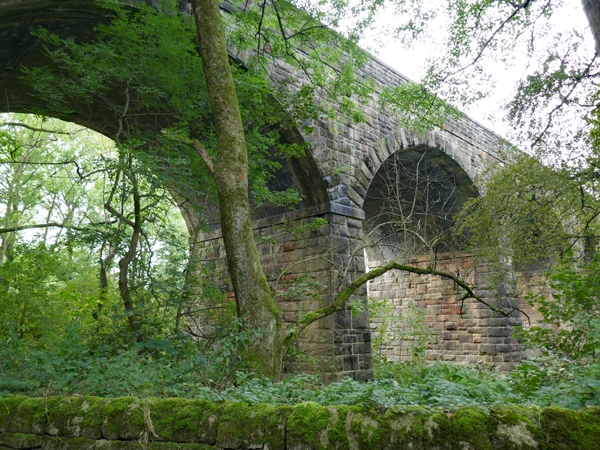
Railway viaduct. c1892. Erected as part of the North Midland Railway extension to Buxton. Snecked and coursed rubble gritstone with massive masonry to viaduct piers. Seven semi-circular arches with brick linings and rusticated voussoirs supported by massive tapering rectangular piers, each with a broad plinth course at the junction of arch and pier. Above arches, a flat band course and coped stone parapets.
Listing NGR: SK2287081316
External links are from the relevant listing authority and, where applicable, Wikidata. Wikidata IDs may be related buildings as well as this specific building. If you want to add or update a link, you will need to do so by editing the Wikidata entry.


Other nearby listed buildings