Latitude: 50.1374 / 50°8'14"N
Longitude: -5.3588 / 5°21'31"W
OS Eastings: 160087
OS Northings: 31767
OS Grid: SW600317
Mapcode National: GBR FX4B.45L
Mapcode Global: VH12W.2TD2
Plus Code: 9C2P4JPR+WF
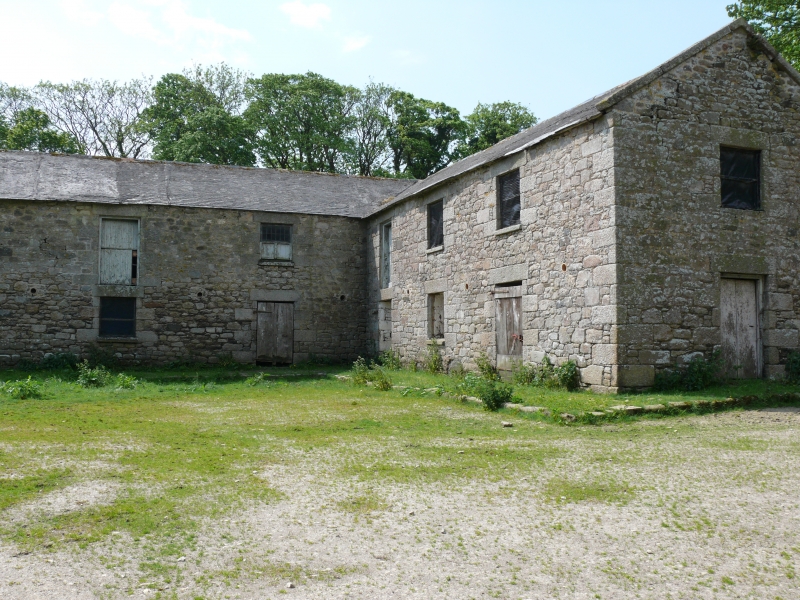
Entry Name: Farm Buildings on West Side of Cow Yard, Including Cobbled Pavements at Approximately 200 Metres South of Godolphin House
Listing Date: 26 August 1987
Grade: II
Source: Historic England
Source ID: 1158786
English Heritage Legacy ID: 65755
ID on this website: 101158786
Location: Godolphin Cross, Cornwall, TR13
County: Cornwall
Civil Parish: Breage
Built-Up Area: Godolphin Cross
Traditional County: Cornwall
Lieutenancy Area (Ceremonial County): Cornwall
Church of England Parish: Breage with Godolphin and Ashton
Church of England Diocese: Truro
Tagged with: Agricultural structure
SW 63 SW BREAGE GODOLPHIN
4/57 Farm building on west side of Cow Yard, including cobbled pavements at approx 200 metres south of Godolphin House
GV II
Originally a shelter or cartshed incorporating an earlier wall, later subdivided and with bull pen added. Circa early C19. Granite rubble, coursed with snecks following the slope of the land to the rear wall, roughly-hewn granite monoliths along the front (east) with later granite rubble with granite dressings, partial infilling between. Hipped scantle slate roof. Long rectangular plan incorporating earlier rear wall, originally with open front carried on granite monolith posts. Cross walls behind some of the posts. High walled pen for bull added left of middle in front and adjoining larger pen at the top end of the yard which also relates to item 7/45. 1 of a group of farm buildings relating to Godolphin House qv. The older coursed west wall against which this shelter was built, continues northwards to include Cow Yard gate and joins onto the large yard (qv) to the rear (south) of Godolphin House. Running obliquely through the courtyard gate (and originally through the gateway to the north) there is an ancient slightly raised causeway of setts with granite kerb stones. It used to lead to the back gate of Godolphin House on axis with the screens passage. Running the length of the back wall of the shelter and on its west side a raised cobbled pavement terminating at a field gate to the south.
Listing NGR: SW6008731767
External links are from the relevant listing authority and, where applicable, Wikidata. Wikidata IDs may be related buildings as well as this specific building. If you want to add or update a link, you will need to do so by editing the Wikidata entry.


Other nearby listed buildings