Latitude: 51.3363 / 51°20'10"N
Longitude: -2.3108 / 2°18'38"W
OS Eastings: 378447
OS Northings: 159740
OS Grid: ST784597
Mapcode National: GBR 0R4.4LF
Mapcode Global: VH96T.WNRX
Plus Code: 9C3V8MPQ+GM
Entry Name: The Hermitage
Listing Date: 1 February 1956
Last Amended: 19 October 1983
Grade: II
Source: Historic England
Source ID: 1158320
English Heritage Legacy ID: 32323
ID on this website: 101158320
Location: Sharpstone, Bath and North East Somerset, Somerset, BA2
County: Bath and North East Somerset
Civil Parish: Freshford
Built-Up Area: Freshford
Traditional County: Somerset
Lieutenancy Area (Ceremonial County): Somerset
Tagged with: Architectural structure
ST 75 NE FRESHFORD C.P. SHARPSTONE
5/46 The Hermitage 1.2.56 II G.V.
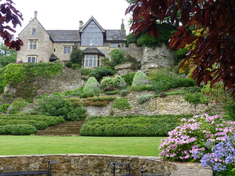
House. Late C14th/C15th; much restored and altered late C19th. Coursed squared rubble with freestone dressings; Cotswold stone slate roofs with coped raised verges; octagonal ashlar stacks. T plan with gabled cross wing to (left) south. 2 storeys and attics. 2 bays. 2- and 3-light casement windows with moulded mullions and transome under drip moulds; in apex of gable, one single light casement with cusped 4-centre arch lintel. Modern door under 4-centred arch lintel and porch with Cotswold stone slate roof in re-entrant angle between wings. Interior: Part of stone newel staircase, with upper part blocked: south-east room has stone recess (possibly an aumbry); 3 arch-braced collar beam trusses in south wing; 2 with cusped windbracing.
Listing NGR: ST7844759740
External links are from the relevant listing authority and, where applicable, Wikidata. Wikidata IDs may be related buildings as well as this specific building. If you want to add or update a link, you will need to do so by editing the Wikidata entry.


Other nearby listed buildings