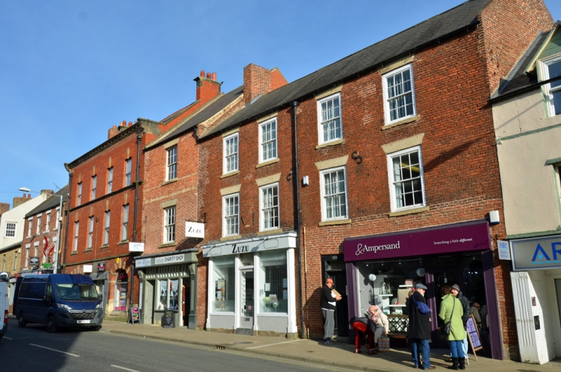
Latitude: 55.1686 / 55°10'6"N
Longitude: -1.6906 / 1°41'26"W
OS Eastings: 419804
OS Northings: 586076
OS Grid: NZ198860
Mapcode National: GBR J8MP.S0
Mapcode Global: WHC2R.0C60
Plus Code: 9C7W5895+CP
Entry Name: 30 and 32, Newgate Street
Listing Date: 22 August 1986
Grade: II
Source: Historic England
Source ID: 1155993
English Heritage Legacy ID: 238741
ID on this website: 101155993
Location: Morpeth, Northumberland, NE61
County: Northumberland
Civil Parish: Morpeth
Built-Up Area: Morpeth
Traditional County: Northumberland
Lieutenancy Area (Ceremonial County): Northumberland
Church of England Parish: Morpeth
Church of England Diocese: Newcastle
Tagged with: Building
NZ 1986
22/252
MORPETH
NEWGATE STREET
(East side)
Nos. 30 and 32
GV
II
Shops with offices over. Early-mid C18. Brick in English Garden Wall Bond.
Welsh slate roof.3 storeys, 4 bays. Ground floor has shop fronts divided by
6-panel door to offices. Shop to left has late C19 front with fluted pilasters.
12-pane sashes above with wedge lintels and projecting sills. Gabled roof with
tumbled-in brickwork. End stacks.
Listing NGR: NZ1980486076
External links are from the relevant listing authority and, where applicable, Wikidata. Wikidata IDs may be related buildings as well as this specific building. If you want to add or update a link, you will need to do so by editing the Wikidata entry.


Other nearby listed buildings