Latitude: 51.7572 / 51°45'25"N
Longitude: -1.8268 / 1°49'36"W
OS Eastings: 412050
OS Northings: 206515
OS Grid: SP120065
Mapcode National: GBR 4RW.T3Y
Mapcode Global: VHB2M.9338
Plus Code: 9C3WQ54F+V7
Entry Name: Bibury Mill
Listing Date: 5 February 1987
Grade: II
Source: Historic England
Source ID: 1155741
English Heritage Legacy ID: 127316
ID on this website: 101155741
Location: Bibury, Cotswold, Gloucestershire, GL7
County: Gloucestershire
District: Cotswold
Civil Parish: Bibury
Built-Up Area: Arlington
Traditional County: Gloucestershire
Lieutenancy Area (Ceremonial County): Gloucestershire
Church of England Parish: Bibury with Winson
Church of England Diocese: Gloucester
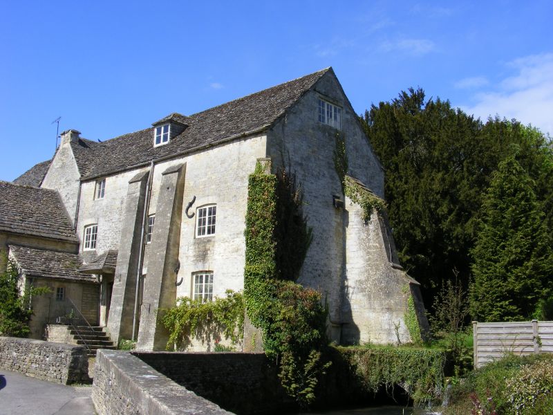
BIBURY BIBURY VILLAGE SP 10 NW 3/70 Bibury Mill GV II Former mill, now storage warehouse. Mainly late C18 or early C19; some late C17 fragments. Random rubble limestone; stone slate roof. Two-storey with attic. East side: many indications of alterations and rebuilding. Two and 3-light scattered mullioned fenestration, 2-light to ground floor appearing late C17. Late C18 chamfered mullioned 3-light. Two tall raking buttresses with top coping to left of range of loading doorways. Single gabled attic dormer. South end: gable end with 3-light casements to ground floor and attic; upper floor loading doorway with single-light to right. North end: attached lower building containing water wheel set over mill race. Interior not inspected. Recorded from 1608. In use as a corn mill in 1920 but disused by 1934. (A.R.J. Jurica, 'Bibury' in V.C.H. Glos. vii, 1981, p 21-44)
Listing NGR: SP1205006515
External links are from the relevant listing authority and, where applicable, Wikidata. Wikidata IDs may be related buildings as well as this specific building. If you want to add or update a link, you will need to do so by editing the Wikidata entry.


Other nearby listed buildings