Latitude: 55.1672 / 55°10'1"N
Longitude: -1.6866 / 1°41'11"W
OS Eastings: 420064
OS Northings: 585918
OS Grid: NZ200859
Mapcode National: GBR J8NP.NJ
Mapcode Global: WHC2R.2D43
Plus Code: 9C7W5887+V9
Entry Name: 59, Bridge Street
Listing Date: 22 August 1986
Grade: II
Source: Historic England
Source ID: 1155554
English Heritage Legacy ID: 238695
ID on this website: 101155554
Location: Morpeth, Northumberland, NE61
County: Northumberland
Civil Parish: Morpeth
Built-Up Area: Morpeth
Traditional County: Northumberland
Lieutenancy Area (Ceremonial County): Northumberland
Church of England Parish: Morpeth
Church of England Diocese: Newcastle
Tagged with: Building
MORPETH BRIDGE STREET NZ 1985 (North side)
24/430 No. 59
GV II
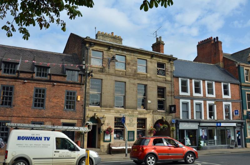
Shop and restaurant. Early-mid C19. Ashlar with Welsh slate roof; brick chimneys and side walls. 3 storeys, 4 windows. Angle pilasters. Round- headed doorway with fanlight to left. In centre, shop front with central doorway. Round-headed carriage entry to right. Corniced fascia over ground floor.
Sash windows in plain reveals on 1st floor. 2nd floor band. 2nd floor windows have sills and aprons. Cornice and blocking course. Shallow-pitched gabled roof with flat coping and large ridge stack.
Listing NGR: NZ2006485924
External links are from the relevant listing authority and, where applicable, Wikidata. Wikidata IDs may be related buildings as well as this specific building. If you want to add or update a link, you will need to do so by editing the Wikidata entry.


Other nearby listed buildings