Latitude: 51.5426 / 51°32'33"N
Longitude: -2.2839 / 2°17'2"W
OS Eastings: 380407
OS Northings: 182674
OS Grid: ST804826
Mapcode National: GBR 0NN.CC5
Mapcode Global: VH95W.CHG8
Plus Code: 9C3VGPV8+2C
Entry Name: Two Houses, Immediately to the West of the Almshouses and Boundary Walls to Road
Listing Date: 3 March 1961
Last Amended: 10 November 1983
Grade: II*
Source: Historic England
Source ID: 1155417
English Heritage Legacy ID: 34262
ID on this website: 101155417
Location: Badminton, South Gloucestershire, GL9
County: South Gloucestershire
Civil Parish: Badminton
Built-Up Area: Badminton
Traditional County: Gloucestershire
Lieutenancy Area (Ceremonial County): Gloucestershire
Church of England Parish: Badminton St Michael and All Angels
Church of England Diocese: Gloucester
Tagged with: Building
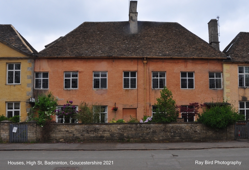
BADMINTON C.P. HIGH STREET (south side) ST 8082 12/52 3.3.61 Two Houses, immediately to the west of The Almshouses G.V. (formerly listed as Houses occupied by Salt and rich) and Boundary Walls to road
II*
Pair of estate houses. Early C18. Rendered; hipped Cotswold stone slate roof; central ashlar stack. 2 storeys. 7 bays : 2-light cross windows with lead cames and iron casement stays; one 3-light window on ground floor to left; 3 blocked windows on first floor. Plank doors to either end under flat stone hood on brackets; blocked door in centre. Low coped, coursed squared rubble boundary walls. Plain examples of Queen Anne style houses, in a very important village street.
Listing NGR: ST8040982674
External links are from the relevant listing authority and, where applicable, Wikidata. Wikidata IDs may be related buildings as well as this specific building. If you want to add or update a link, you will need to do so by editing the Wikidata entry.


Other nearby listed buildings