Latitude: 54.9757 / 54°58'32"N
Longitude: -2.0201 / 2°1'12"W
OS Eastings: 398808
OS Northings: 564567
OS Grid: NY988645
Mapcode National: GBR GBBX.F4
Mapcode Global: WHB2D.Y66C
Plus Code: 9C6VXXGH+7W
Entry Name: 3, St Helens Street
Listing Date: 24 May 1988
Grade: II
Source: Historic England
Source ID: 1155324
English Heritage Legacy ID: 239956
ID on this website: 101155324
Location: Corbridge, Northumberland, NE45
County: Northumberland
Civil Parish: Corbridge
Built-Up Area: Corbridge
Traditional County: Northumberland
Lieutenancy Area (Ceremonial County): Northumberland
Church of England Parish: Corbridge with Halton and Newton Hall
Church of England Diocese: Newcastle
Tagged with: Building
CORBRIDGE ST HELEN'S STREET NY 9864 (North Side)
21/195 No 3
II
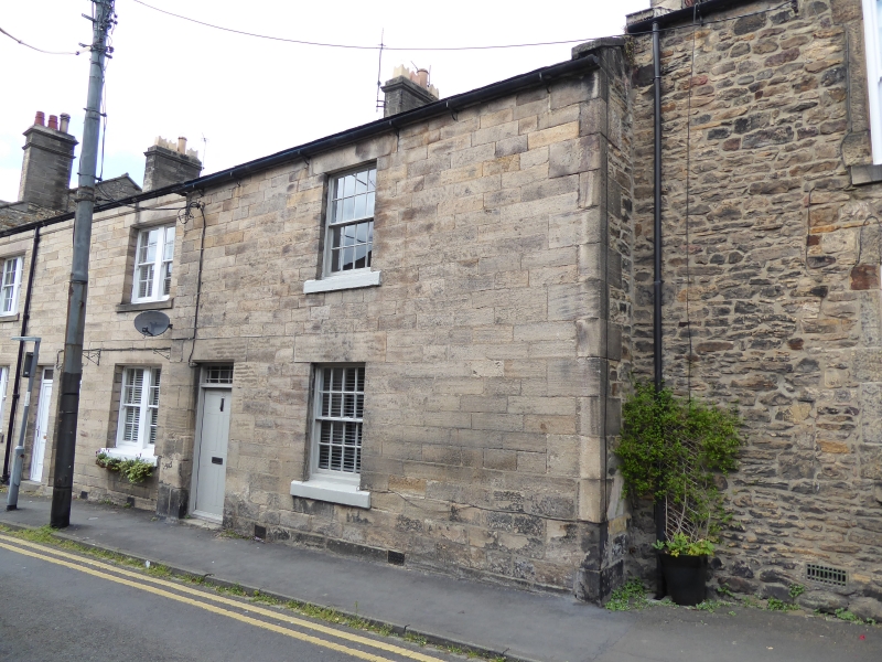
House. Early C19. Squared stone with tooled quoins and dressings; Welsh slate roof, stack heightened in brick. 2 storeys, 1 bay. Flush-panelled door, with margined overlight, in chamfered surround on left; 16-pane sash windows with tooled lintels and slightly-projecting sills. Coped right gable with stepped end stack.
Listing NGR: NY9880864567
External links are from the relevant listing authority and, where applicable, Wikidata. Wikidata IDs may be related buildings as well as this specific building. If you want to add or update a link, you will need to do so by editing the Wikidata entry.


Other nearby listed buildings