Latitude: 51.6361 / 51°38'9"N
Longitude: -2.1578 / 2°9'28"W
OS Eastings: 389174
OS Northings: 193041
OS Grid: ST891930
Mapcode National: GBR 1P0.79T
Mapcode Global: VH95K.K43M
Plus Code: 9C3VJRPR+CV
Entry Name: Number 16 and Rosemount
Listing Date: 21 March 1985
Grade: II
Source: Historic England
Source ID: 1154683
English Heritage Legacy ID: 128599
ID on this website: 101154683
Location: Tetbury, Cotswold, Gloucestershire, GL8
County: Gloucestershire
District: Cotswold
Civil Parish: Tetbury
Built-Up Area: Tetbury
Traditional County: Gloucestershire
Lieutenancy Area (Ceremonial County): Gloucestershire
Church of England Parish: Tetbury St Mary the Virgin
Church of England Diocese: Gloucester
Tagged with: Building
ST 8893-8993 TETBURY SILVER STREET (east side)
7/324 No 16 and Rosemount
GV II
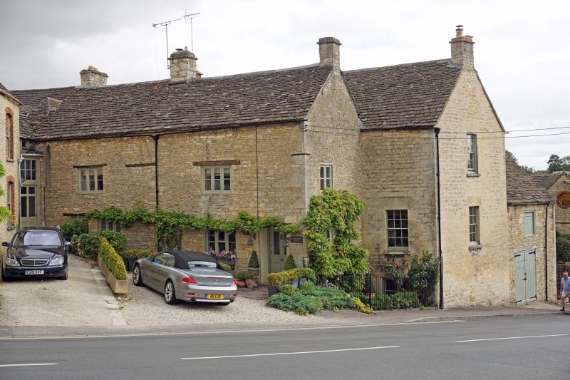
Large house with small cottage in one corner (to south west). Front range late C17, rear parallel staggered range of mid C18. Front range in rubble stone with quoins, rear in coursed rubble stone with quoins, both with Cotswold stone slate roofs. Front range has central ridge and right gable stone stacks, rear has left hand brick and right hand stone gable stacks. 2 storeys and basements, at ground level at rear. 2 windows (originally 3), 3- light wood casements with wood lintels. 2 on ground floor with door to No 16 on left, and to Rosemount in recess on right, both half glazed 4-panel doors. Right return has one 2-light casement on each floor. Rear range has 12-pane sashes on right corner and return, with large stone lintels, and to rear facade. On rear corner of right return, rubble stone 2-storey former stable block with quoins, double carriage doors and square opening above.
Listing NGR: ST8917493041
External links are from the relevant listing authority and, where applicable, Wikidata. Wikidata IDs may be related buildings as well as this specific building. If you want to add or update a link, you will need to do so by editing the Wikidata entry.


Other nearby listed buildings