Latitude: 55.6398 / 55°38'23"N
Longitude: -2.1075 / 2°6'27"W
OS Eastings: 393328
OS Northings: 638473
OS Grid: NT933384
Mapcode National: GBR F3Q7.J4
Mapcode Global: WH9Z2.LHMV
Plus Code: 9C7VJVQR+WX
Entry Name: Heatherslaw Bridge
Listing Date: 10 March 1988
Grade: II
Source: Historic England
Source ID: 1154240
English Heritage Legacy ID: 238083
ID on this website: 101154240
Location: Old Heatherslaw, Northumberland, TD12
County: Northumberland
Civil Parish: Ford
Traditional County: Northumberland
Lieutenancy Area (Ceremonial County): Northumberland
Church of England Parish: Ford And Etal
Church of England Diocese: Newcastle
Tagged with: Bridge
FORD HETHERSLAW NT 93 NW 10/116 Hetherslaw Bridge GV II
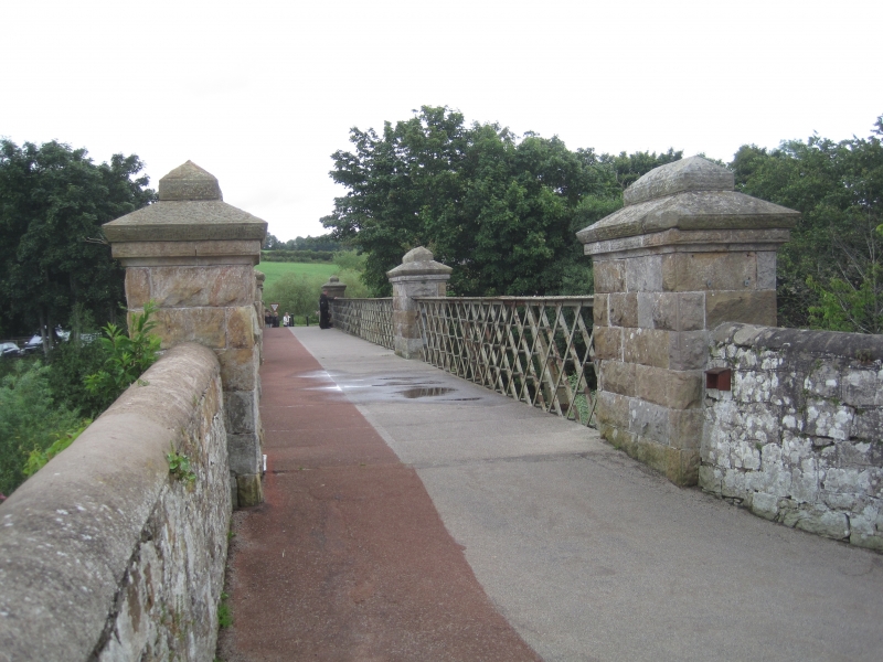
Bridge. Cast iron, steel and rock-faced stone. 1877 by A. & J. Main and Co., Glasgow. Large corniced end piers and mid-point piers. Roadway supported on large iron beams. The roadway itself is made of perforated iron strips. Steel trellis parapet.
Listing NGR: NT9332838473
External links are from the relevant listing authority and, where applicable, Wikidata. Wikidata IDs may be related buildings as well as this specific building. If you want to add or update a link, you will need to do so by editing the Wikidata entry.


Other nearby listed buildings