Latitude: 51.7113 / 51°42'40"N
Longitude: -1.8838 / 1°53'1"W
OS Eastings: 408126
OS Northings: 201397
OS Grid: SP081013
Mapcode National: GBR 3R1.QJX
Mapcode Global: VHB2S.97GZ
Plus Code: 9C3WP468+GF
Entry Name: The Hope
Listing Date: 17 June 1986
Grade: II
Source: Historic England
Source ID: 1152063
English Heritage Legacy ID: 129819
ID on this website: 101152063
Location: Ampney St Peter, Cotswold, Gloucestershire, GL7
County: Gloucestershire
District: Cotswold
Civil Parish: Ampney St. Peter
Traditional County: Gloucestershire
Lieutenancy Area (Ceremonial County): Gloucestershire
Church of England Parish: Ampney St Peter with St Mary
Church of England Diocese: Gloucester
Tagged with: Architectural structure
SP 00 SE AMPNEY ST. PETER AMPNEY ST. PETER VILLAGE (west side) )
5/76 The Hope
4.6.52
GV II
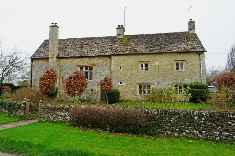
Originally small detached cottage of C17, with extension to rear, and large addition to side probably of early C20. Rubble stone, stone slate roof, originally with stone end stacks, that to left now a ridge stack, with stone lateral external stack with offset to left hand side. 'L'-shape range, with 2 storeys to east and single storey and attic to rear. Original part has 2 windows, 2-light stone mullions with square hoodmould, and 3-light similar below flanking blocked original doorway. Two very small lights to left indicate position of newel stair. Wing to left has plank door in stone surround with square hoodmould and large 3-light stone mullion and transom with leaded lights. South face has 2-light stone mullion on first floor, 3-light on ground floor. Rear wing has 4 hipped dormers to south and scattered openings some with timber lintel.
Listing NGR: SP0812601397
External links are from the relevant listing authority and, where applicable, Wikidata. Wikidata IDs may be related buildings as well as this specific building. If you want to add or update a link, you will need to do so by editing the Wikidata entry.


Other nearby listed buildings