Latitude: 53.5279 / 53°31'40"N
Longitude: -1.6488 / 1°38'55"W
OS Eastings: 423375
OS Northings: 403523
OS Grid: SE233035
Mapcode National: GBR JWXN.T2
Mapcode Global: WHCBP.NL1B
Plus Code: 9C5WG9H2+4F
Entry Name: Barn at Redminster Cottage
Listing Date: 27 April 1988
Grade: II
Source: Historic England
Source ID: 1151838
English Heritage Legacy ID: 334105
ID on this website: 101151838
Location: Thurlstone, Barnsley, South Yorkshire, S36
County: Barnsley
Civil Parish: Penistone
Built-Up Area: Penistone
Traditional County: Yorkshire
Lieutenancy Area (Ceremonial County): South Yorkshire
Church of England Parish: Thurlstone St Saviour
Church of England Diocese: Sheffield
Tagged with: Barn
PENISTONE TOWNGATE SE20SW (east side), Thurlstone 3/74 Barn at Redminster Cottage
II
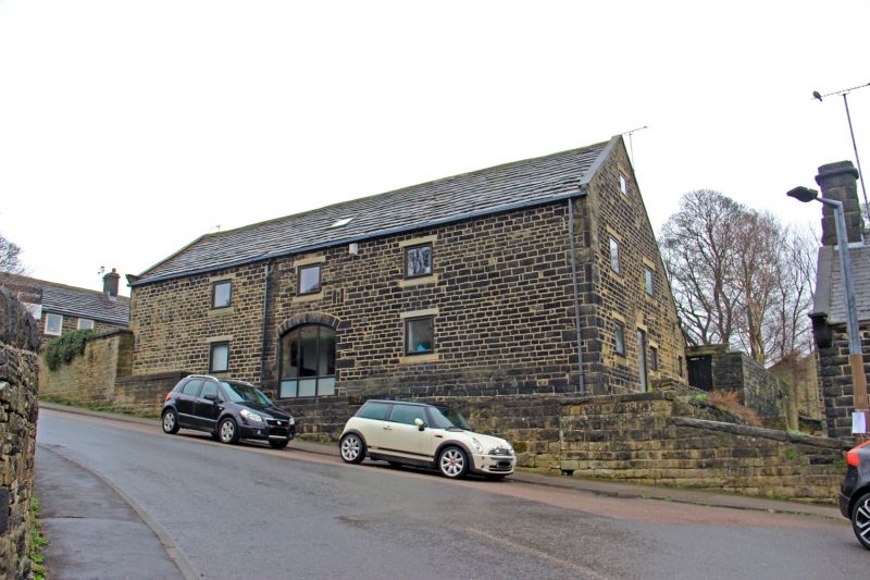
Barn. Early C18. Coursed squared rubble. Stone slate roof. Five internal bays. Quoins. Central square-headed cart-entry with gabled dovecote above of red brick, possibly slightly later. Continuous outshuts to left and right. Rear: opposing blocked cart-entry with segmental head and quoined surround. Entrance with quoined surround in right return.
Interior: 3-bay stone, round-arched arcade supports each outshut, an unusual feature for this area.
Listing NGR: SE2337503523
External links are from the relevant listing authority and, where applicable, Wikidata. Wikidata IDs may be related buildings as well as this specific building. If you want to add or update a link, you will need to do so by editing the Wikidata entry.


Other nearby listed buildings