Latitude: 54.3227 / 54°19'21"N
Longitude: -1.4617 / 1°27'42"W
OS Eastings: 435108
OS Northings: 492037
OS Grid: SE351920
Mapcode National: GBR LL7G.B6
Mapcode Global: WHD81.JM50
Plus Code: 9C6W8GFQ+38
Entry Name: Howden Bridge
Listing Date: 31 March 1970
Grade: II
Source: Historic England
Source ID: 1150974
English Heritage Legacy ID: 332140
ID on this website: 101150974
Location: Warlaby, North Yorkshire, DL7
County: North Yorkshire
District: Hambleton
Civil Parish: Romanby
Traditional County: Yorkshire
Lieutenancy Area (Ceremonial County): North Yorkshire
Church of England Parish: Northallerton All Saints
Church of England Diocese: York
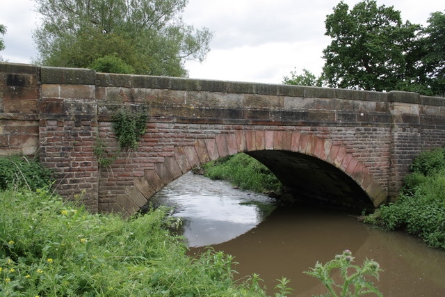
SE 39 SE AINDERBY STEEPLE NORTHALLERTON ROAD (south side, off) 2/3 Howden Bridge 31.3.70 II Bridge. C15 and late C19. Ashlar and coursed squared stone. 2 western pointed chamfered arches are medieval with ribbed archivolts and, between them, a triangular-section cutwater rising into pedestrian retreat. Eastern C19 segmental arch has voussoirs and pilasters breaking forward to either side. Band corbelled across pilasters. Parapet. Half the bridge is in the parish of Romanby.
Listing NGR: SE3510992036


Other nearby listed buildings