Latitude: 54.1355 / 54°8'7"N
Longitude: -1.5251 / 1°31'30"W
OS Eastings: 431129
OS Northings: 471179
OS Grid: SE311711
Mapcode National: GBR KNSM.M9
Mapcode Global: WHC7V.K90Z
Plus Code: 9C6W4FPF+6X
Entry Name: Lamb and Flag Public House
Listing Date: 19 March 1984
Grade: II
Source: Historic England
Source ID: 1150173
English Heritage Legacy ID: 330076
ID on this website: 101150173
Location: Ripon, North Yorkshire, HG4
County: North Yorkshire
District: Harrogate
Civil Parish: Ripon
Built-Up Area: Ripon
Traditional County: Yorkshire
Lieutenancy Area (Ceremonial County): North Yorkshire
Church of England Parish: Ripon Cathedral Parish with Littlethorpe
Church of England Diocese: Leeds
Tagged with: Pub
SE 3171
1/241
RIPON
HIGH SKELLGATE
(west side)
No 9
(Lamb and Flag Public House)
GV
II
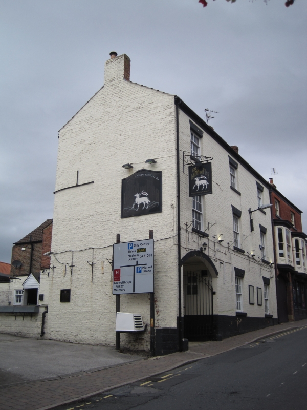
Early C19. White-washed brick. Three storeys. Wooden brackets to eaves. Three
bays: sashes with glazing bars. Segment-headed carriage entrance at south end: spur
stones.
Listing NGR: SE3112971179
External links are from the relevant listing authority and, where applicable, Wikidata. Wikidata IDs may be related buildings as well as this specific building. If you want to add or update a link, you will need to do so by editing the Wikidata entry.


Other nearby listed buildings