Latitude: 54.0071 / 54°0'25"N
Longitude: -1.4674 / 1°28'2"W
OS Eastings: 435004
OS Northings: 456916
OS Grid: SE350569
Mapcode National: GBR LQ63.3B
Mapcode Global: WHD9L.FJGY
Plus Code: 9C6W2G4M+R2
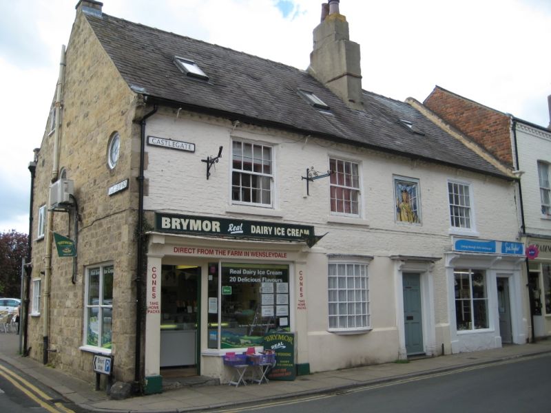
Entry Name: 1, 1A, Castlegate
Listing Date: 15 May 1968
Grade: II
Source: Historic England
Source ID: 1149890
English Heritage Legacy ID: 330742
ID on this website: 101149890
Location: Knaresborough, North Yorkshire, HG5
County: North Yorkshire
District: Harrogate
Civil Parish: Knaresborough
Built-Up Area: Knaresborough
Traditional County: Yorkshire
Lieutenancy Area (Ceremonial County): North Yorkshire
Church of England Parish: Knaresborough
Church of England Diocese: Leeds
Tagged with: Building
SE 3556 KNARESBOROUGH CASTLEGATE (west side)
9/79 Nos 1 and 1A 15.5.68 GV II
House, now 2 shops with dwelling over. Early C18 with C19 and C20 alterations. Painted brick, Westmorland slate roof. 2 storeys, 3 bays. Central 6-panel door in wooden architrave with brackets supporting cornice. C20 bow window to left, plate-glass shop window and entrance to far left. 4-pane shop window and door to right. 1st floor: 16-pane sashes, blind window above door. Large stack forward of ridge above door. Left return probably rebuilt C20 in coursed stone, new openings. Interior not inspected.
Listing NGR: SE3500456916
External links are from the relevant listing authority and, where applicable, Wikidata. Wikidata IDs may be related buildings as well as this specific building. If you want to add or update a link, you will need to do so by editing the Wikidata entry.


Other nearby listed buildings