Latitude: 54.23 / 54°13'47"N
Longitude: -1.0101 / 1°0'36"W
OS Eastings: 464625
OS Northings: 482034
OS Grid: SE646820
Mapcode National: GBR PMDJ.3F
Mapcode Global: WHF9S.GY64
Plus Code: 9C6W6XHQ+XW
Entry Name: The Vicarage
Listing Date: 18 March 1985
Grade: II
Source: Historic England
Source ID: 1149295
English Heritage Legacy ID: 328238
ID on this website: 101149295
Location: Harome, North Yorkshire, YO62
County: North Yorkshire
District: Ryedale
Civil Parish: Harome
Traditional County: Yorkshire
Lieutenancy Area (Ceremonial County): North Yorkshire
Church of England Parish: Harome St Saviour
Church of England Diocese: York
Tagged with: Clergy house
SE 6482 HAROME
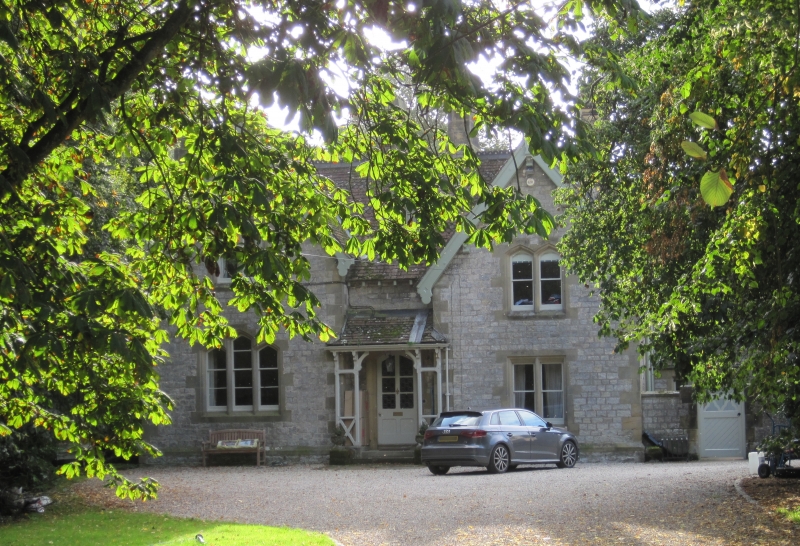
11/12 The Vicarage - GV II
House. c1860-70. Probably by Charles Barry Junior. Limestone with sandstone detailing. Plain and fish scale tiles in alternating bands to roof, stone stacks. Main block: 2 rooms in depth and 2 rooms wide with large staircase hall. Contemporary service wing to right with outshut and coalhouse projecting at front. 2 storeys, balanced asymmetrical facade. 2 gabled bays breaking forward slightly on either side of arched half-glazed door in wooden porch with lean-to roof. 3 stepped arched sashes to left, and one 2-light sash to left. First floor has two 2-light arched sashes and one single-light dormer. Bargeboards to gables, decorative cresting to ridges. Tall ridge and eaves stacks. Included for group considerations.
Listing NGR: SE6462582034
External links are from the relevant listing authority and, where applicable, Wikidata. Wikidata IDs may be related buildings as well as this specific building. If you want to add or update a link, you will need to do so by editing the Wikidata entry.


Other nearby listed buildings