Latitude: 54.3407 / 54°20'26"N
Longitude: -1.2095 / 1°12'34"W
OS Eastings: 451493
OS Northings: 494191
OS Grid: SE514941
Mapcode National: GBR MLZ7.YR
Mapcode Global: WHD85.D596
Plus Code: 9C6W8QRR+76
Entry Name: Limekiln Approximately 50 Metres to West of Plane Tree Hall Farm
Listing Date: 14 March 1986
Grade: II
Source: Historic England
Source ID: 1149198
English Heritage Legacy ID: 328533
ID on this website: 101149198
Location: North Yorkshire, DL6
County: North Yorkshire
District: Ryedale
Civil Parish: Hawnby
Traditional County: Yorkshire
Lieutenancy Area (Ceremonial County): North Yorkshire
Church of England Parish: Upper Ryedale
Church of England Diocese: York
Tagged with: Lime kiln
SE 59 SW
4/57
SNILESWORTH
HALL LANE
(north side)
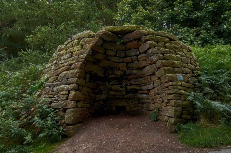
Limekiln approximately 50 metres to west of Plane Tree Hall Farm
II
Limekiln. c1800. Sandstone rubble. c7 metres in height. Circular
structure with tall arch and flue to rear.
Listing NGR: SE5149394191
External links are from the relevant listing authority and, where applicable, Wikidata. Wikidata IDs may be related buildings as well as this specific building. If you want to add or update a link, you will need to do so by editing the Wikidata entry.


Other nearby listed buildings